Experiments
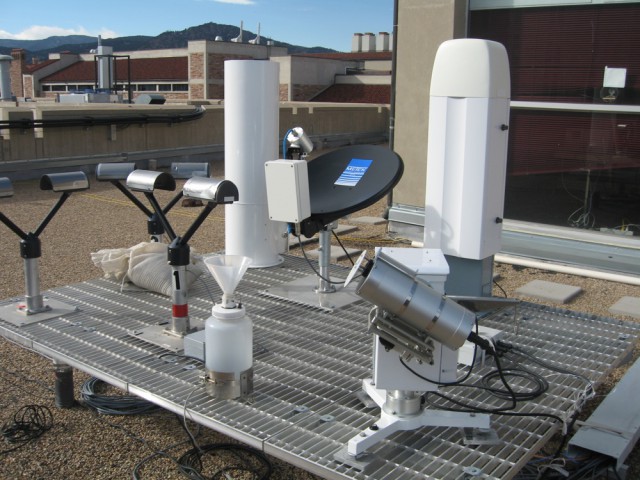
We are currently operating two PARSIVEL disdrometers, a micro rain radar, and a radiometer. If not deployed in one of the many field campaigns, the instruments are part of the Study of COnvective and Orographic Precipitation (SCOOP) project and are deployed along the Colorado Front Range. Besides operating her own instruments, Prof. Friedrich has been the instrument PI for Doppler on Wheels radars for many experiments.
Colorado Hail Accumulation from Thunderstorms (CHAT) project aims to collect hail accumulation reports and study the behavior of hail-producing thunderstorms with dual-polarization weather radars and a lightning mapping array. Starting in 2016, we have asked amateur meteorologists and storm spotters to send text, photos, video, and drone footage relating to hail depth, hail size, and hail swath using Facebook, Twitter, telephone, or email since hail depth is currently not required in the storm reports.
The SCOOP (Study of COnvective and Orographic Precipitation) focuses on investigating the multi-scale interactions existing between kinematic and microphysical processes during orographic precipitation events. SCOOP consists of four enhanced-observation sites at several elevations along an east-west topographic transect extending from the High Plains region east of the Rocky Mountains to the Continental Divide provide direct measurements of hydrometeor characteristics, precipitation, surface meteorology and near surface radiometric fluxes across the Colorado Front Range. The observation sites are located at the U. of Colorado Campus, Marshall Field operated by the National Center for Atmospheric Research (NCAR), and at several sites at the U. of Colorado Mountain Research Station.
Winter Precipitation Type Research Multiscale Experiment (WINTRE-MIX) is an U.S.-Canadian research program, conducted in Montreal, CA, focusing on better understanding how multi-scale processes influence the variability and predictability of precipitation type and amount in near-freezing surface conditions.
The overarching goal of SNOWIE (Seeded and Natural Orographic Wintertime Clouds: The Idaho Experiment) is to understand the natural dynamical and microphysical processes by which precipitation forms and evolves within orographic winter storms and to determine the physical processes by which cloud seeding with silver iodide (AgI), either from ground generators or aircraft, impacts the amount and spatial distribution of snow falling across a river basin. SNOWIE was conducted in the Payette Mountains in Idaho and partners with Idaho Power Company (IPC) who maintains an operational seeding program in the region.
WFIP2 is a research project sponsored by the Department of Energy that aims to improve the skill of NOAA’s short-term weather forecast models at predicting foundational weather parameters (for example, wind speed, turbulence intensity, and icing conditions) that impact wind energy generation. The experiment was conducted along the Columbia River Gauge, OR.
Experimental Planetary Boundary Layer Instrumentation Assessment (XPIA) was conducted between March and April 2015 at the Boulder Atmospheric Observatory in collaboration with the educational outreach project Characterizing the Atmospheric Boundary Layer (CABL). The goal was to compare multiple remote sensing devices to reference measurements.
The goal of this experiment was to compare remote sensing devices, Windcube lidar and microwave radiometer, to meteorological in-situ tower measurements to demonstrate the accuracy of these measurements and to assess the utility of the remote sensing instruments in overcoming tower limitations. The instruments were co-located at the U.S. Department of Energy National Renewable Energy Laboratory’s National Wind Technology Center near Boulder, CO, between May – October 2011 and 2012.
Demonstrate the gap-filling potential of a small Doppler radar within the coverage area of the national Weather Service WSR-88D radar at Grand Junction, CO and examine the terrain-induced circulations favorable for storm formation and motion. It was conducted in Durango, CO in August 2010.
Intercomparing reflectivity and rainfall rate measurements of MRRs and disdrometer. It was conducted in Boulder, CO between March and May 2010.
Inhibition of Snowfall by Pollution Aerosols (ISPA) studies the link between pollution aerosols and snowfall rates in the Mount Werner area near Steamboat Springs, Colorado.Steamboat, CO 14 Jan – 28 Feb 2010.
The second Verification of the Origins of Rotation in Tornadoes Experiment (VORTEX2) is a multi-agency field program to investigate i) tornadogenesis, maintenance, and demise, ii) tornado near-ground wind field, iii) relationships among tornadoes, their parent thunderstorms, and the larger-scale environment, and iv) numerical weather predication of supercells and tornadoes. It was condcuted in the Great Plains between 10 May – 13 June 2009 and 1 May – 15 June 2010.
Demonstrate the gap-filling potential of a small Doppler radar within the coverage area of the national Weather Service WSR-88D radar at Grand Junction, CO and examine the terrain-induced circulations favorable for storm formation and motion. It was conducted in Durango, CO between 15 Jul – 31 August 2009.
Major goals are to collect observaions that will enable the evaluation of tornadogenesis hypotheses and to continue studies of tornado vortex structure and climatology. Great Plains 1 – 31 May 2008
Older Projects:
Radar de Franche-Comte, INTERREG IIIa: Analyzing the added benefit of polarimetric measurements for rainfall rate estimation and forecast in the Alps, focusing on the influence of terrain and multiple water phases on the measurement accuracy of polarimetric quantities; international project between MeteoSwiss and the French weather service, Meteo France, (2005-2007).
Modernization of the Swiss national weather radar network: How to modernize the national weather radar network to better address users’ needs, and conduct scientific requirements with the focus on utility ad feasibility of polarimetry for operational applications? (2005-2007).
International H2O project (IHOP 2000): Investigating kinematic and microphysical structures of a cold front and analyze the role of those structures relevant for convection initiation (2004-2005).
Convection and Precipitation/Electrification project (CaPE 1991): Conducting a statistical analysis of strength and frequency of misocyclones observed along thunderstorm outflows and the role of misocyclones on convection initiation (2004-2005).
Vertical Exchange and orography in the Alpine foreland (VERTIKATOR 2000): Using polarimetic Doppler radar together with three bistatic receivers to investigate the influence of orography on the onset of convection and downburst-producing thunderstorms using polarimetric radar data and wind-vector fields (2001-2004).
Frankfurt/Main International Airport (FRAPORT): Development of a concept of using weather-radar data (wind vector fields and radar reflectivity) for air-traffic management at Frankfurt/Main International Airport; project was commissioned by th Ministry of Transportation (2002-2003).
European COST, Action 717: Developing and testing concepts for an automated determination of radar-data quality for radar reflectivity, polarimetric parameters, and Doppler velocity for assimilation in numerical weather prediction models (2002-2004).
WakeVortex: Measurement and post-processing wind-vector fields to be assimilated into a numerical weather prediction model (2000-2004).
Atmospheric Dynamic Mission (ADM): Quality control algorithm for Doppler lidar measurements which should come into operation during the Atmospheric Dynamic Mission starting in 2007 (2002-2004).
Tropospheric Research Program (TSF): Investigation the influence of land-use heterogeneity on water and energy budgets (1993-1999).