Cloud Seeding
SNOWIE – Seeded and Natural Orographic Wintertime clouds: the Idaho Experiment
Throughout the western U.S. and other semi-arid mountainous region across the globe, water supplies are fed primarily through the melting of snowpack. Growing populations place higher demands on water while warmer winters and earlier springs reduce its supply. Water managers are tantalized by the prospect of cloud seeding as a way to increase winter snowfall thereby shifting the balance between water supply and demand. Little direct scientific evidence exists that confirm even the basic physical hypothesis upon which cloud seeding relies. The intent of glaciogenic seeding of orographic clouds is to introduce aerosol into a cloud to alter the nucleation of ice crystals, followed by ice particle growth to sizes sufficiently large such that snow falls to the ground. Despite numerous experiments spanning several decades, no direct observations of this process exist.
Here, measurements from radars and aircraft-mounted cloud physics probes are presented that together show the initiation, growth, and fallout to the mountain surface of ice crystals resulting from glaciogenic seeding. These data, by themselves, do not address the question of cloud seeding efficacy, but rather form a critical set of observations necessary for such investigations. These are the first unambiguous observations of the physical chain of events following the introduction of glaciogenic cloud seeding aerosol into supercooled liquid orographic clouds.
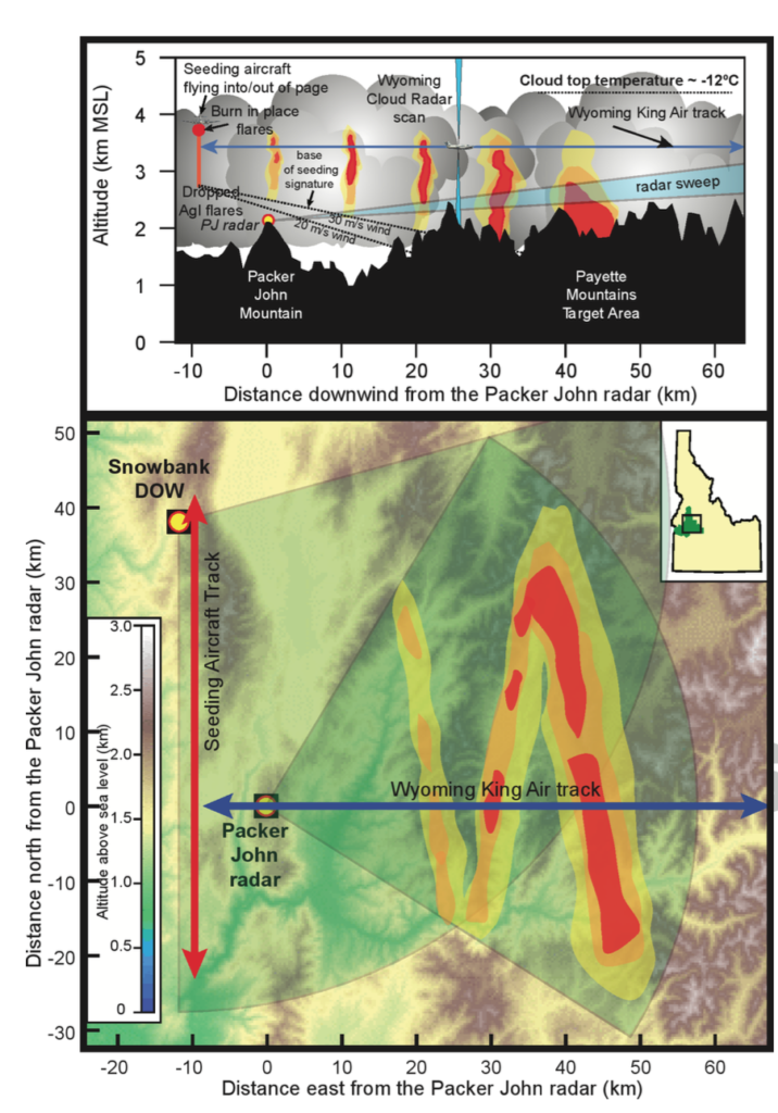
Fig. 1: A conceptual illustration of the anticipated seeding signature and the experimental design as part of SNOWIE. In both panels, the yellow-orange-red colors indicate locations and relative magnitude of radar returns. Yellow dots show locations of ground based radars, red lines represent typical flight tracks for the seeding aircraft and blue lines are flight tracks for the Wyoming King Air. The bottom panel shows a plan view and the top panel shows a vertical cross-section along the flight track of the WKA. Seeding material is released either as burn-in-place or ejectable flares. Vertical depth of echoes as a function of downwind distance depends in part on wind speed. The bases of the radar echo descend as particles grow and fall, illustrated by the dashed line in the top panel for two different wind speeds. Here, we assume constant wind speed with height. Wind direction from west to east (left to right across the figure)
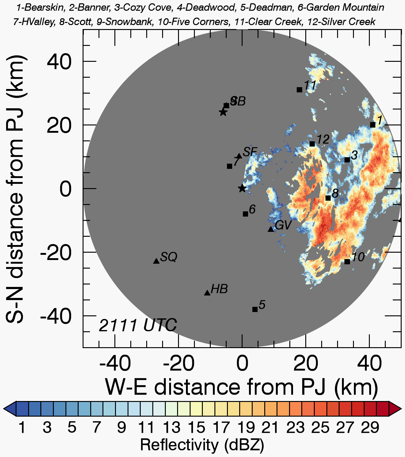
Fig.2: PPI of radar reflectivity fro the ground-based Doppler on Wheels (DOW) radar located at Packer John. The scans were conducted at 2deg elevation angle and, therefore, show reflcetivity just above ground level close to the radar to roughly 1.7 km above ground level at 50 km range. The red line indicate the track of the seeding aircraft, which was repeated eight times. Wind speed at flight level was about 20 m/s from southwest.