XPIA May-June 2015
NWTC 2012-2014
WFIP2 2015-2016
XPIA May-June 2015
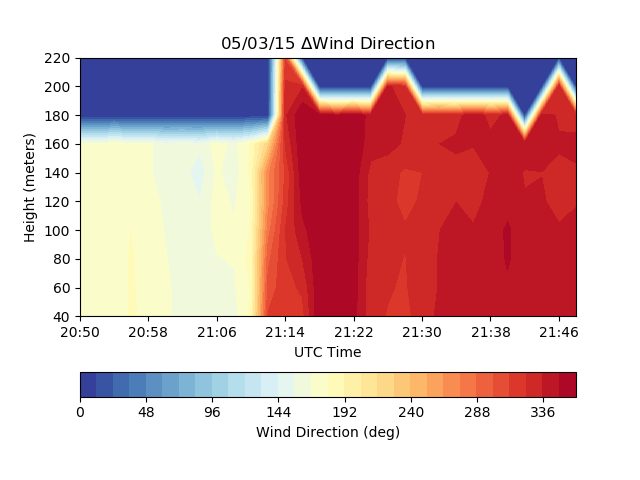
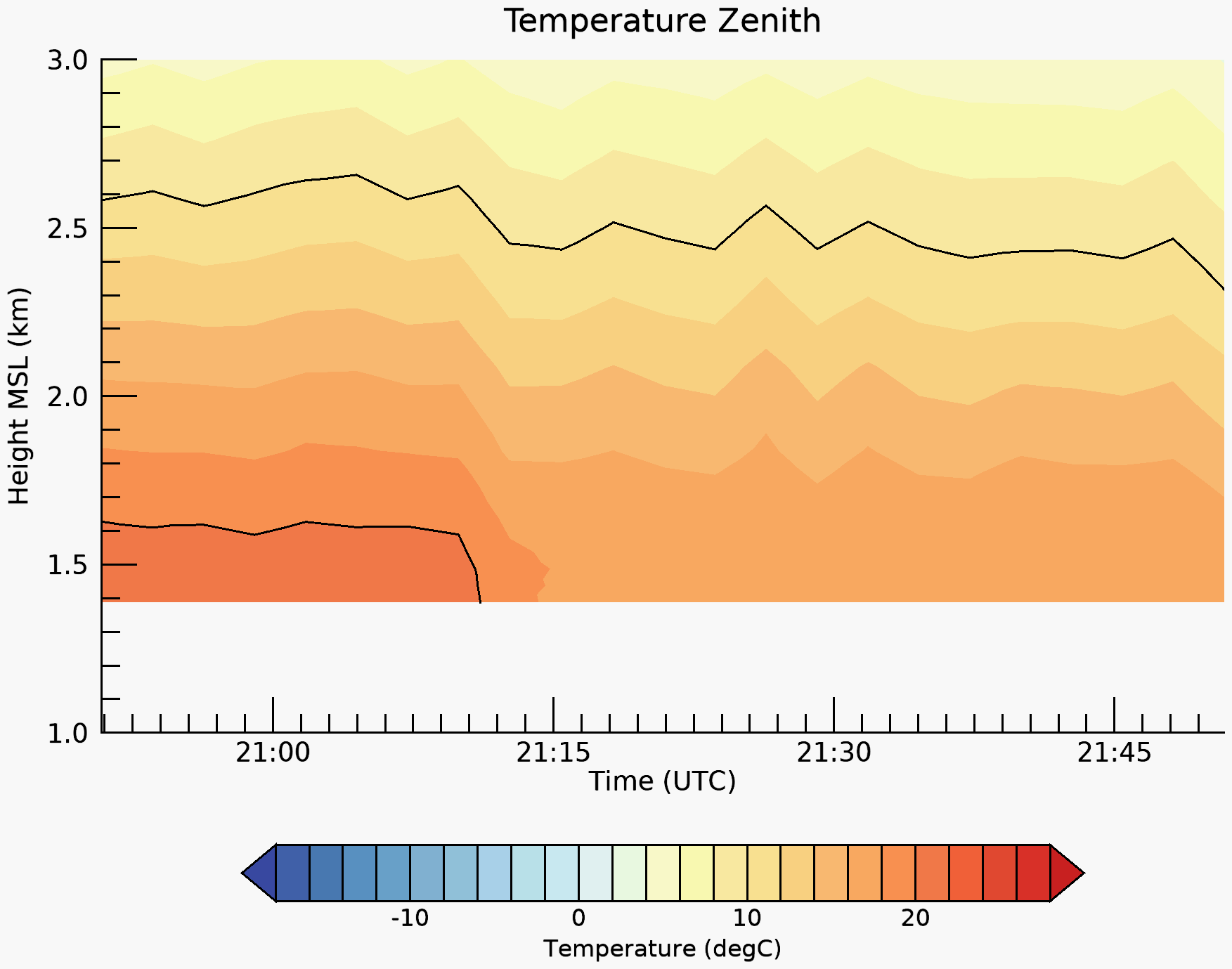
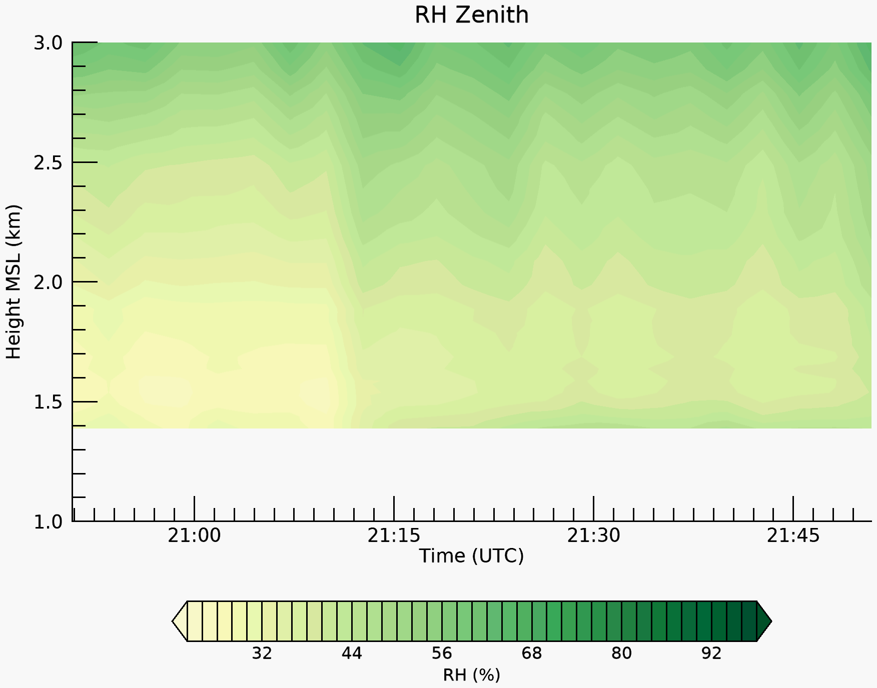
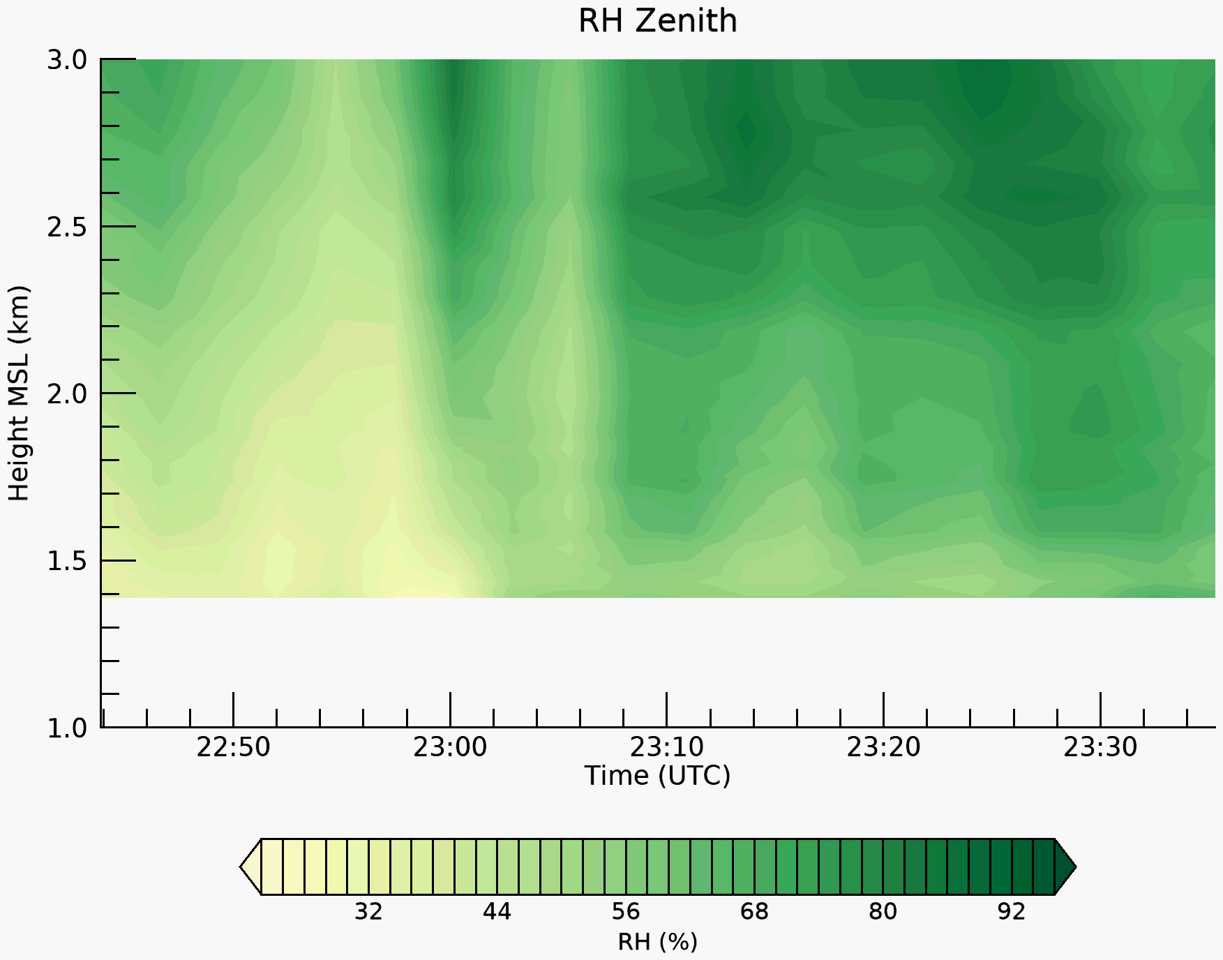
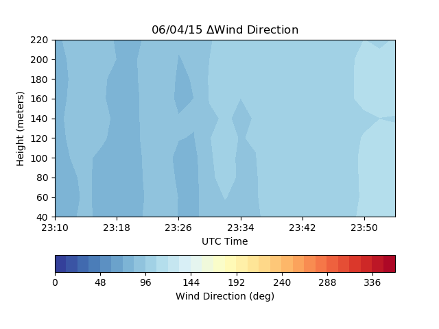
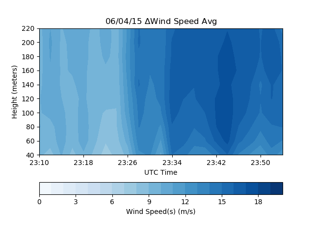
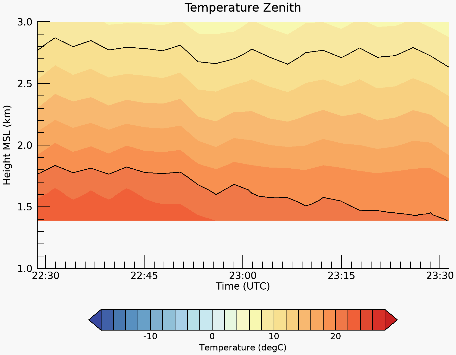
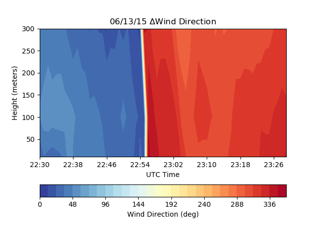
Site: BAO Coordinates: 39 54 .6340,-105 13 .4110 (indicated by white dot in the radar image) Elevation (m): 1584
* BAO Tower substitutes days without Lidar and/or Radiometer
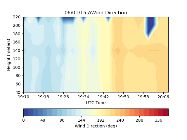
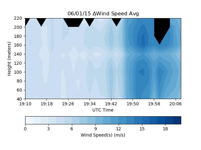
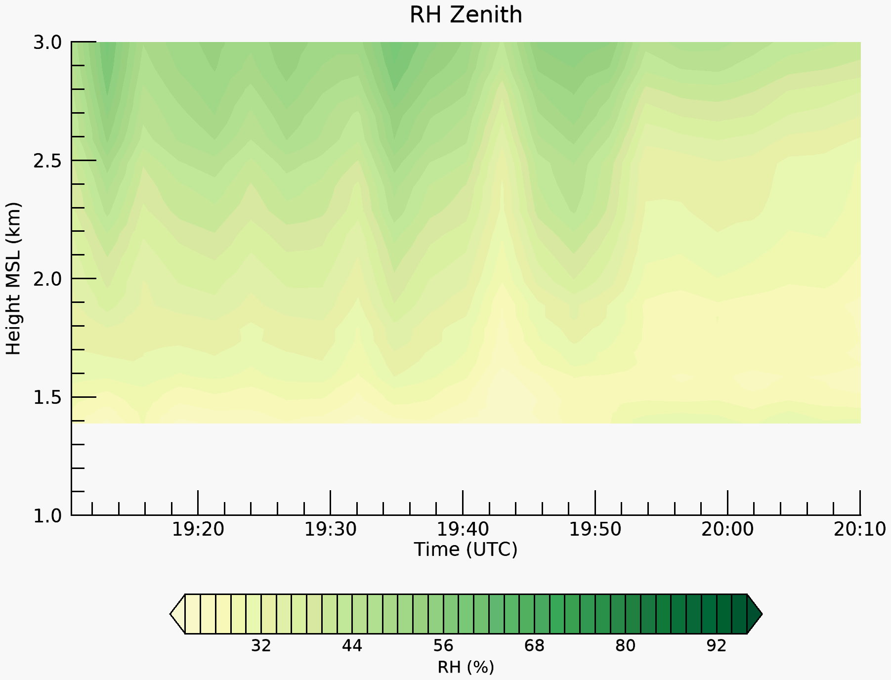
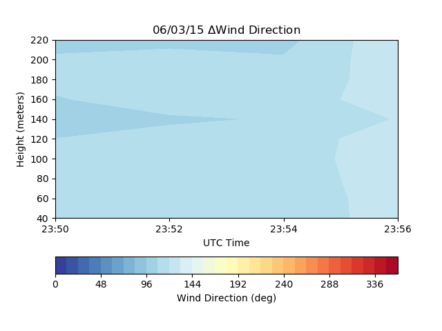
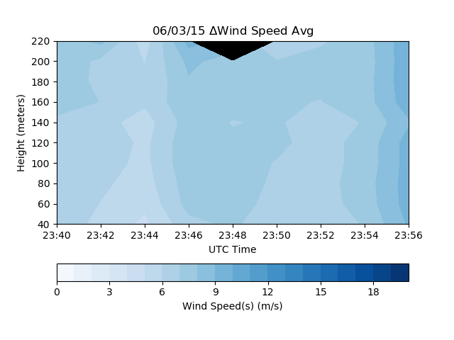
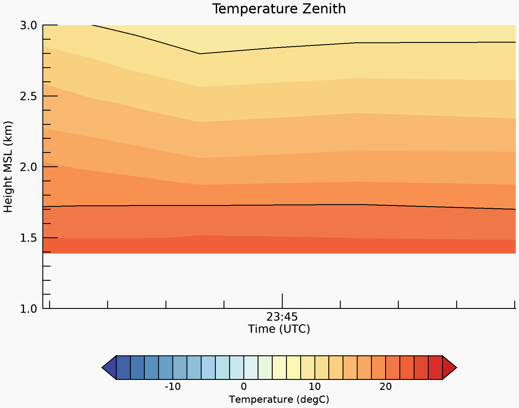
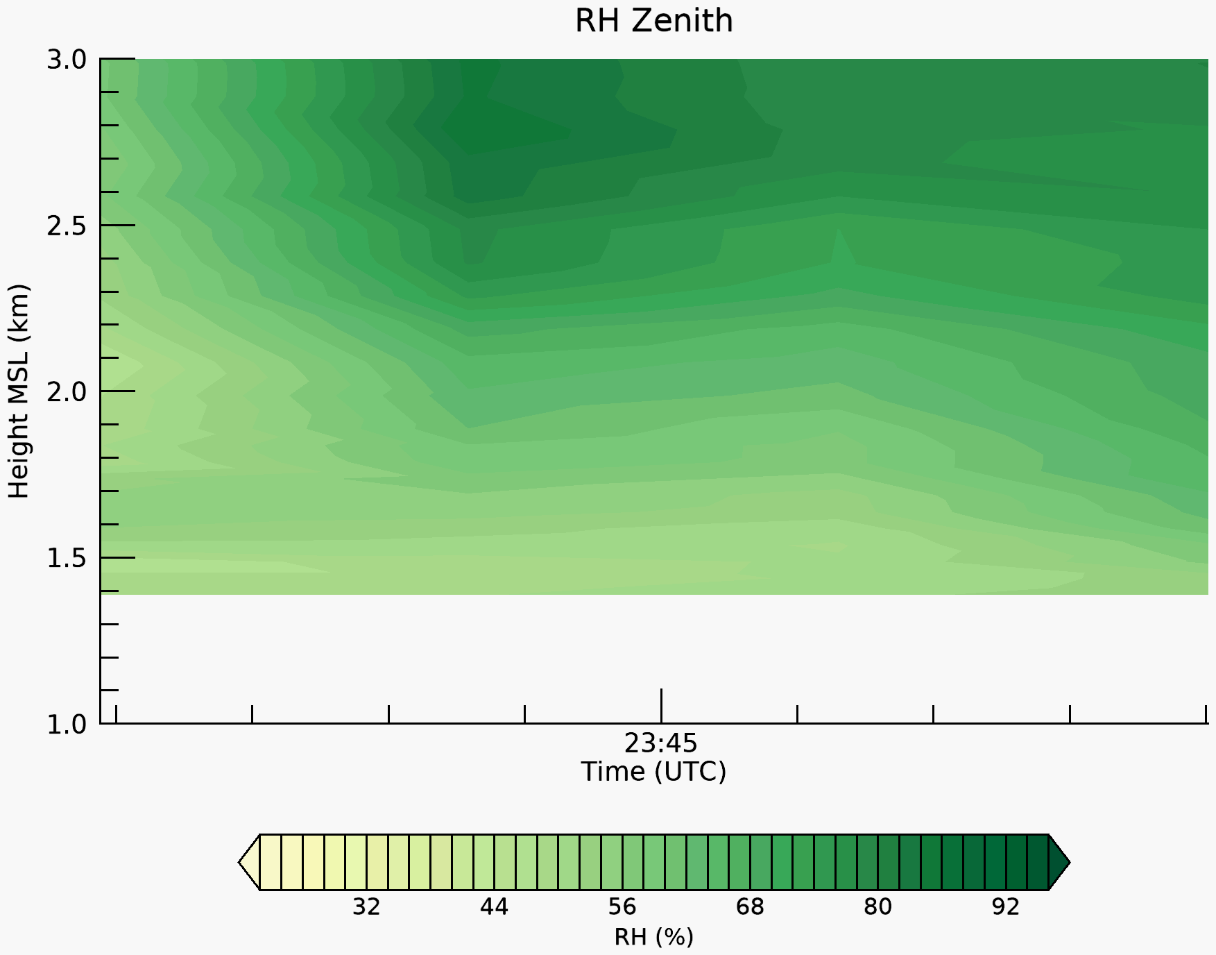
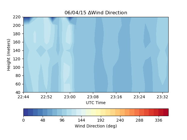
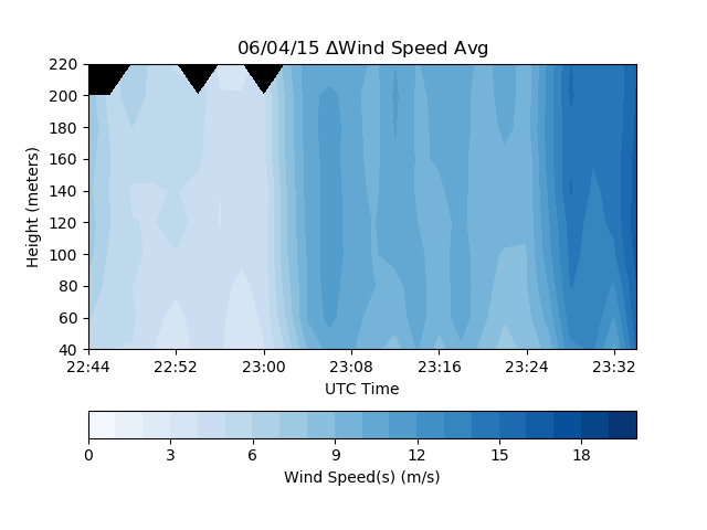
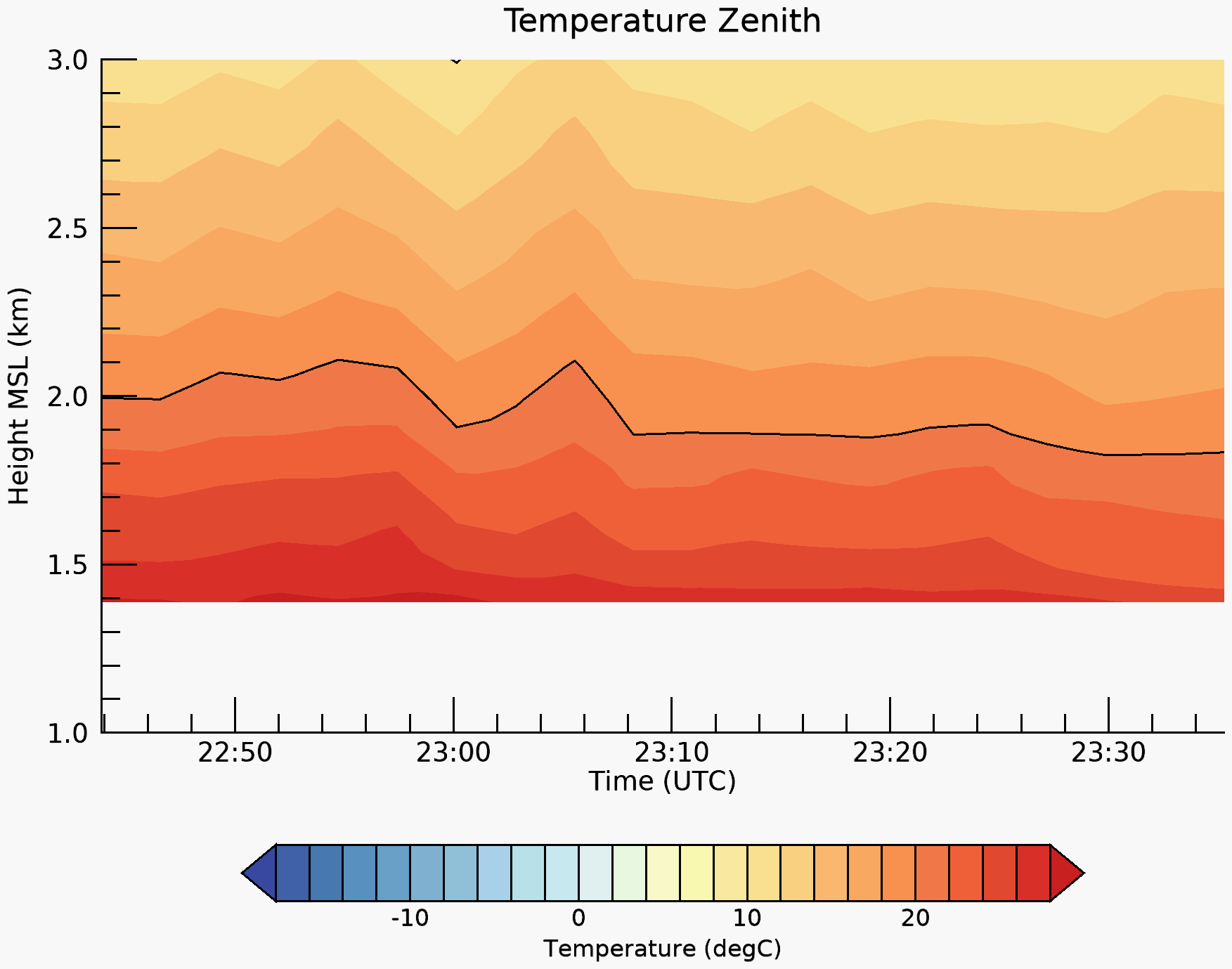
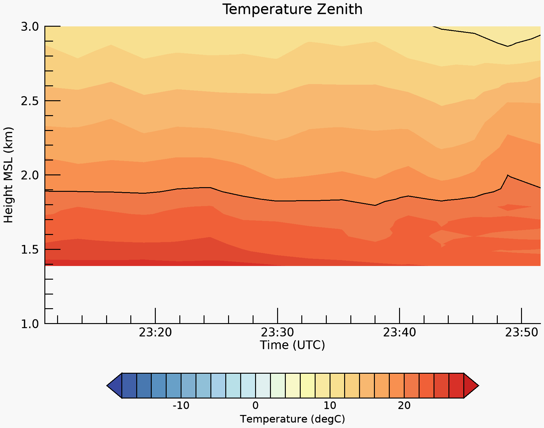
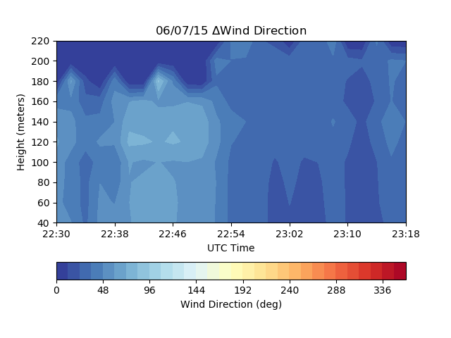
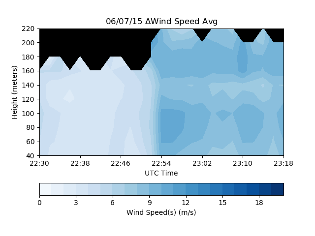
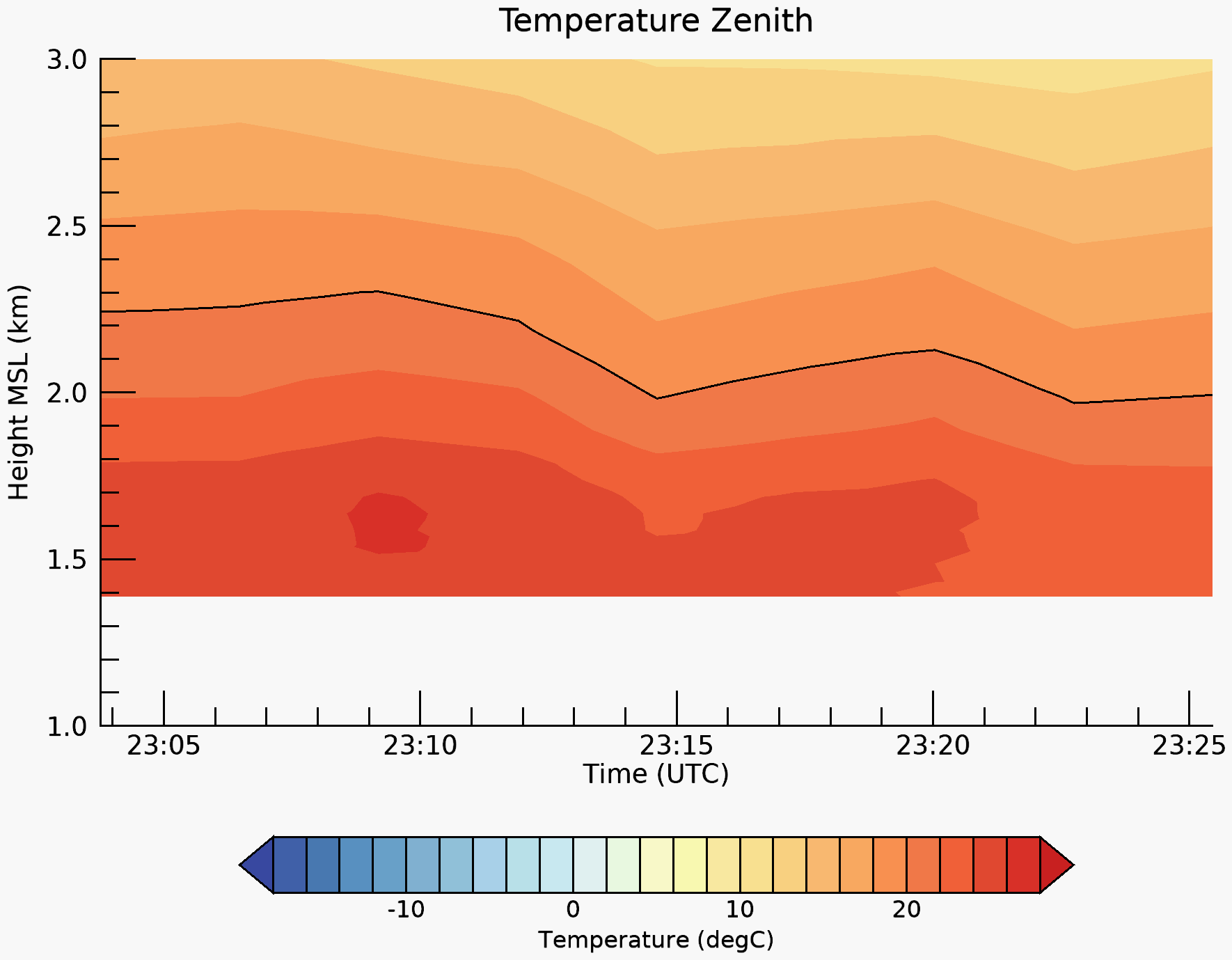
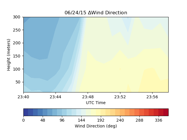
| Date | Radar image | Lidar wind direction | Lidar wind speed | Radiometer temp | Radiometer RH |
|---|---|---|---|---|---|
| 3 May | 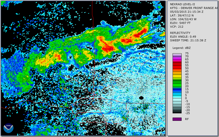 |
 |
 |
 |
 |
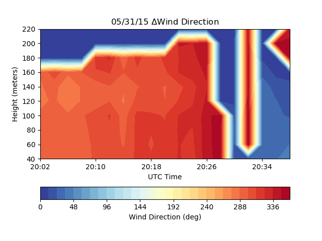
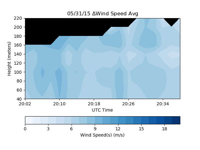
| 31 May | 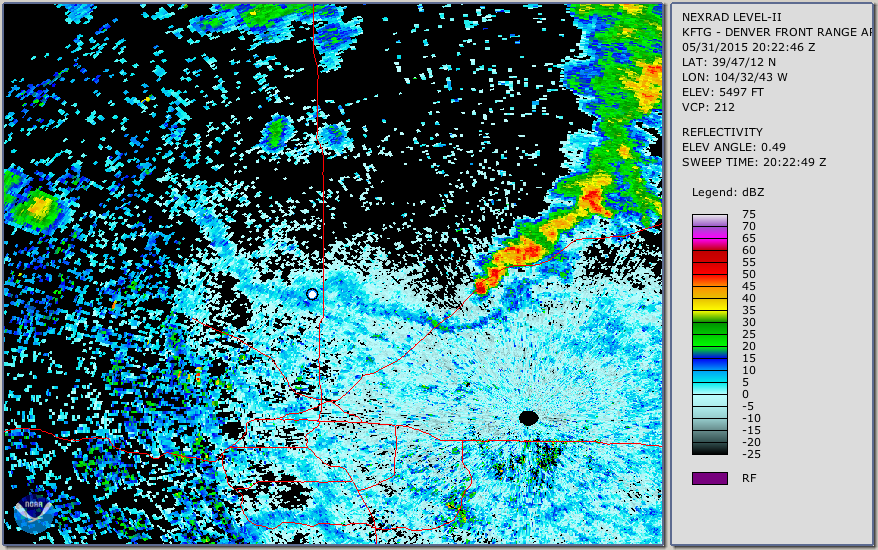 |
 |
 |
 |
 |
| 1 June | 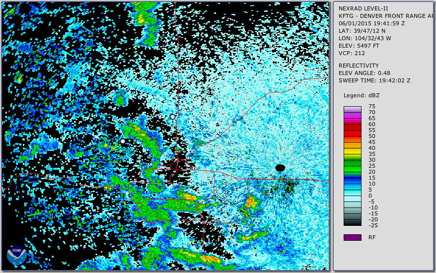 |
 |
 |
 |
 |
| 3 June | 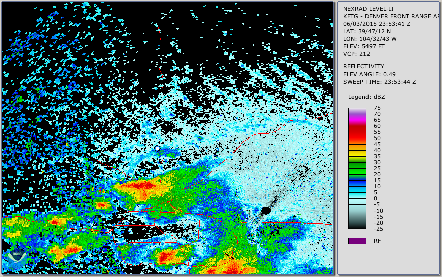 |
 |
 |
 |
 |
| 4 June (1) | 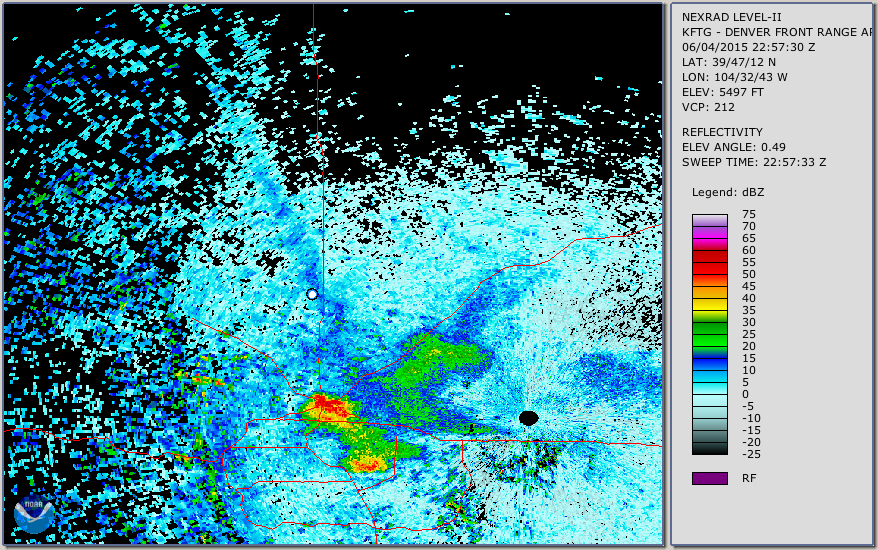 |
 |
 |
 |
 |
| 4 June (2) | 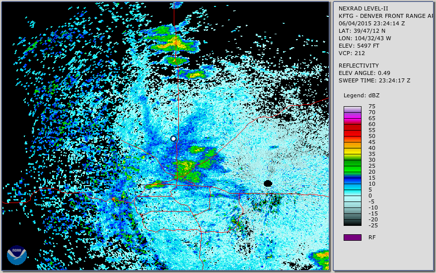 |
 |
 |
 |
 |
| 7 June | 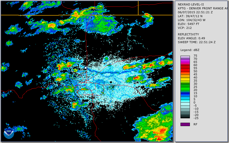 |
 |
 |
 |
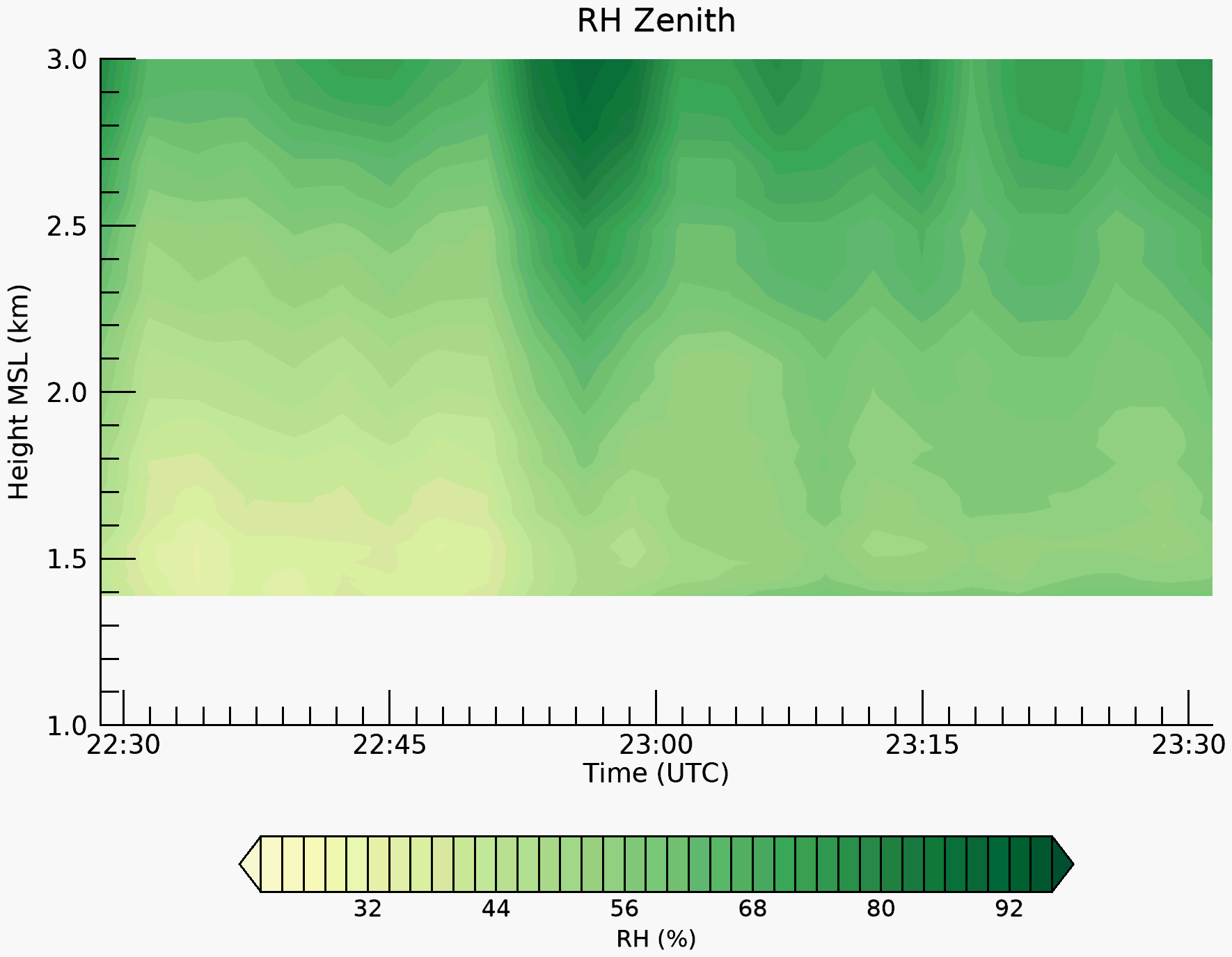 |
| 13 June | 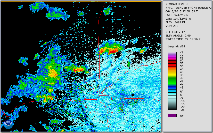 |
 |
 |
 |
 |
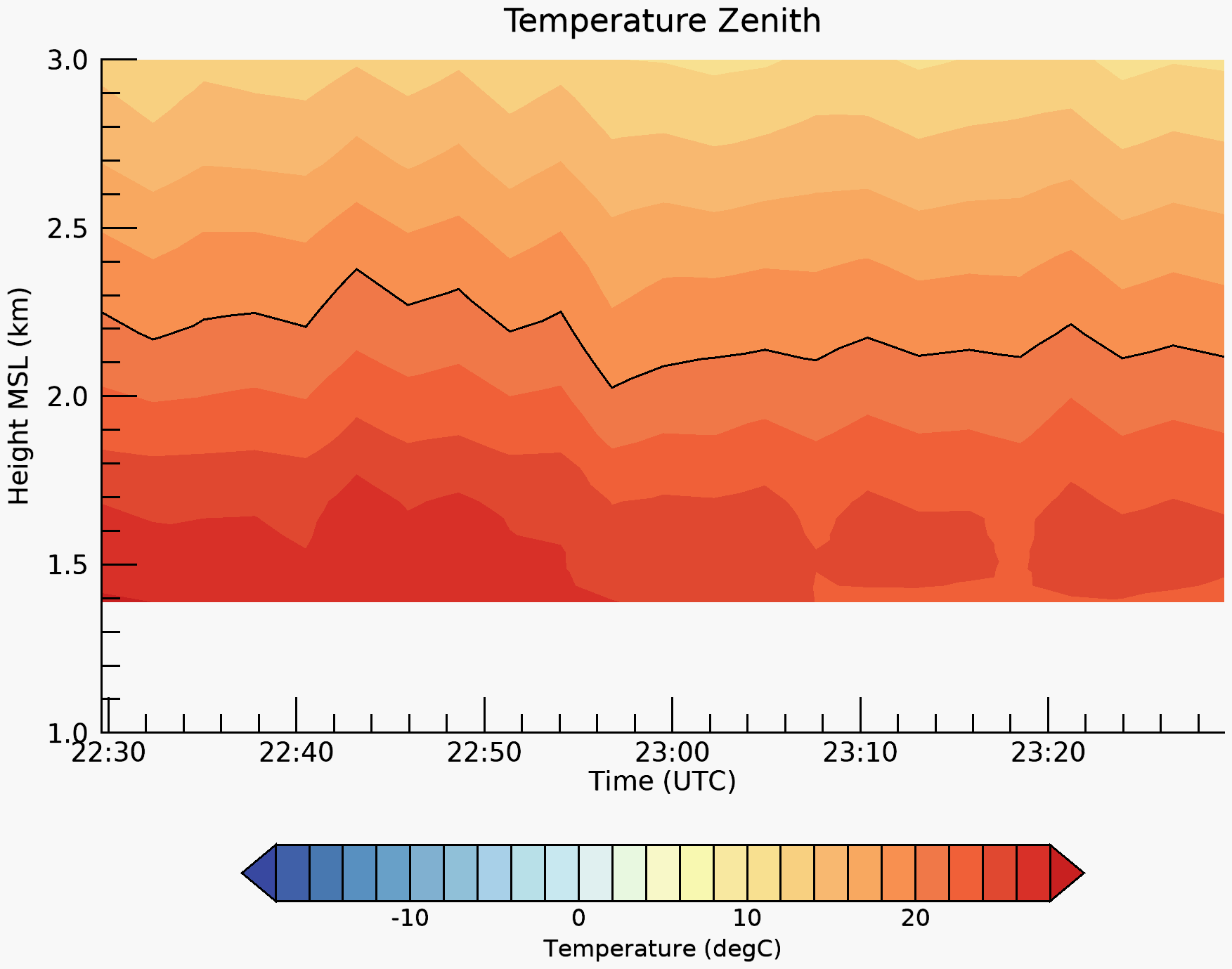
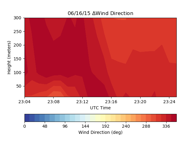
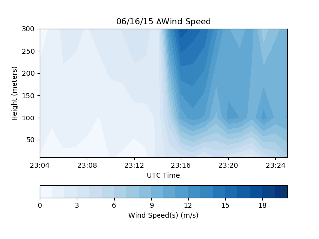
| 16 June | 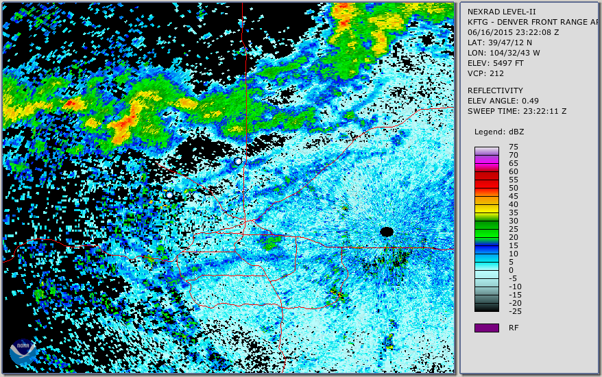 |
 |
 |
 |
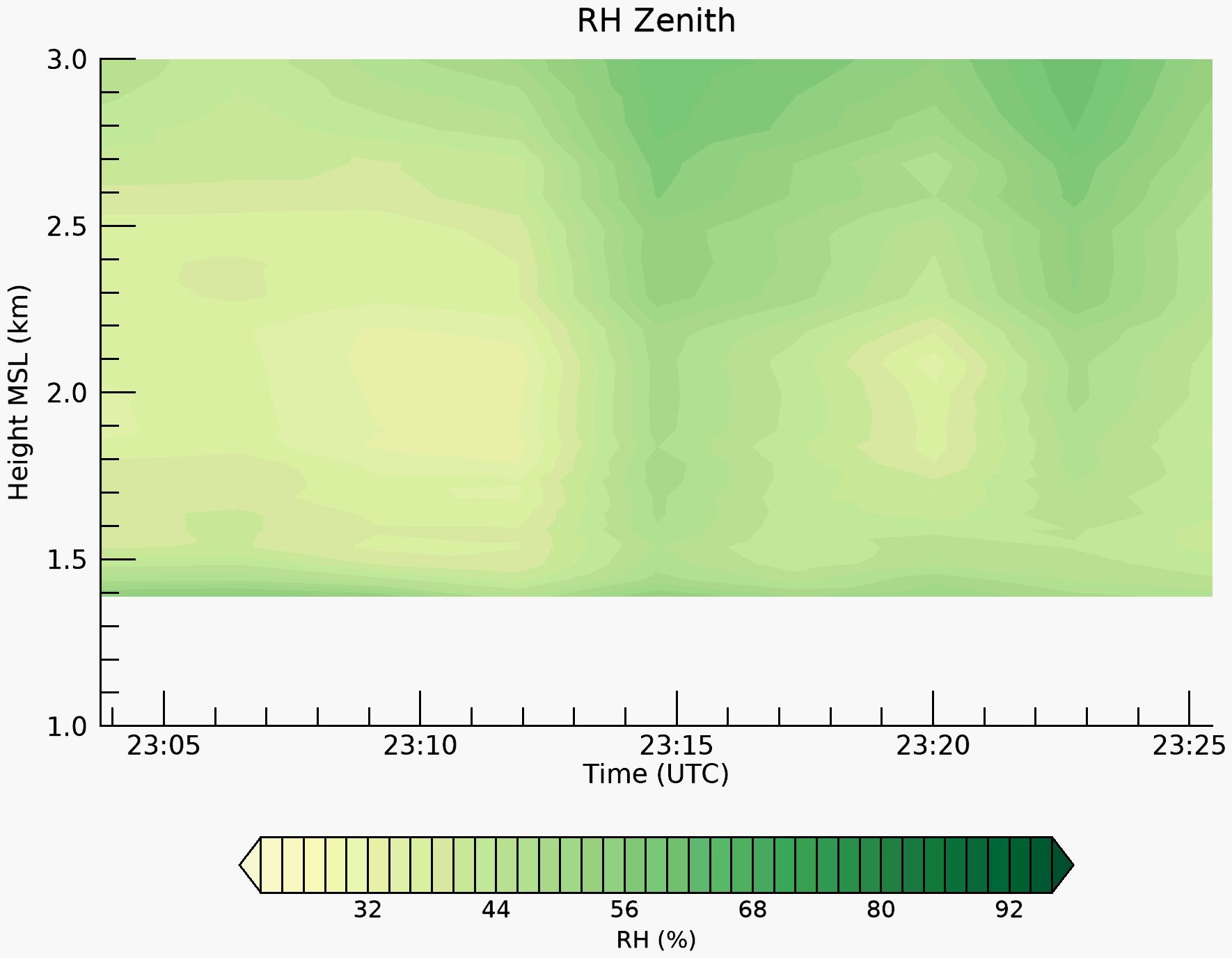 |
| 24 June | 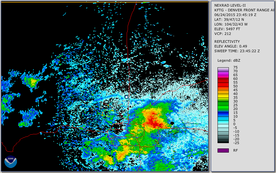 |
 |
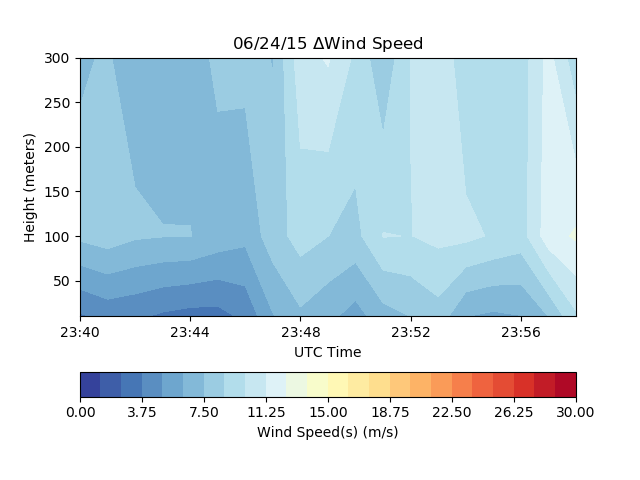 |
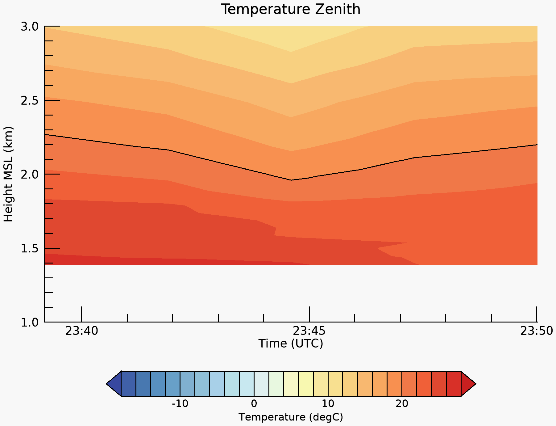 |
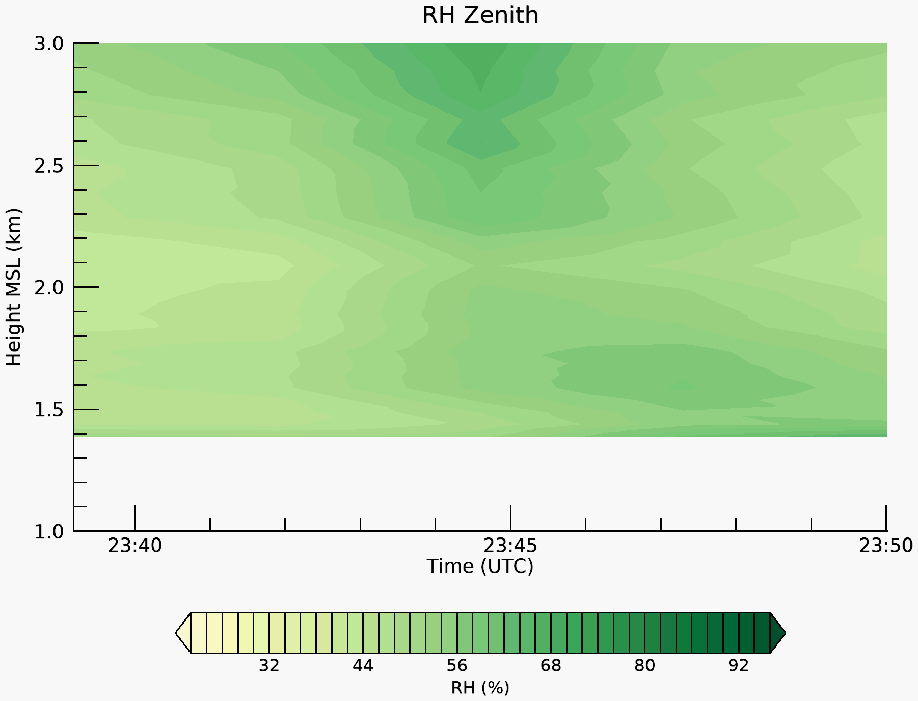 |
| 25 June |  |
 |
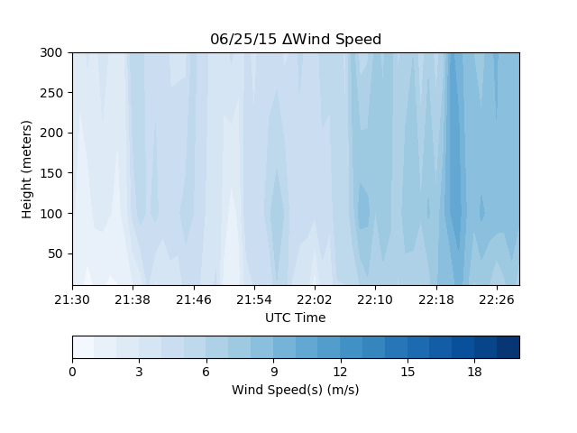 |
 |
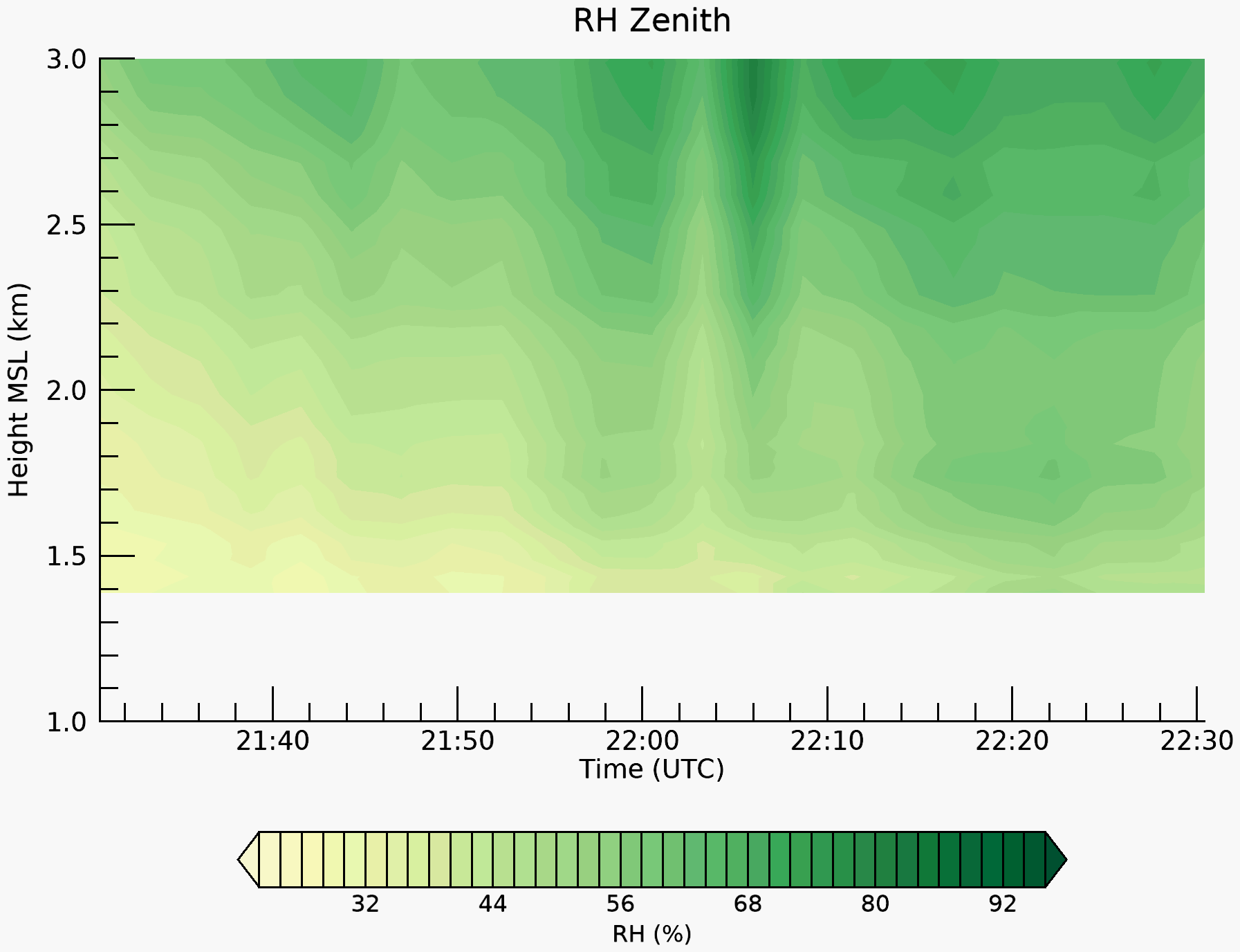 |
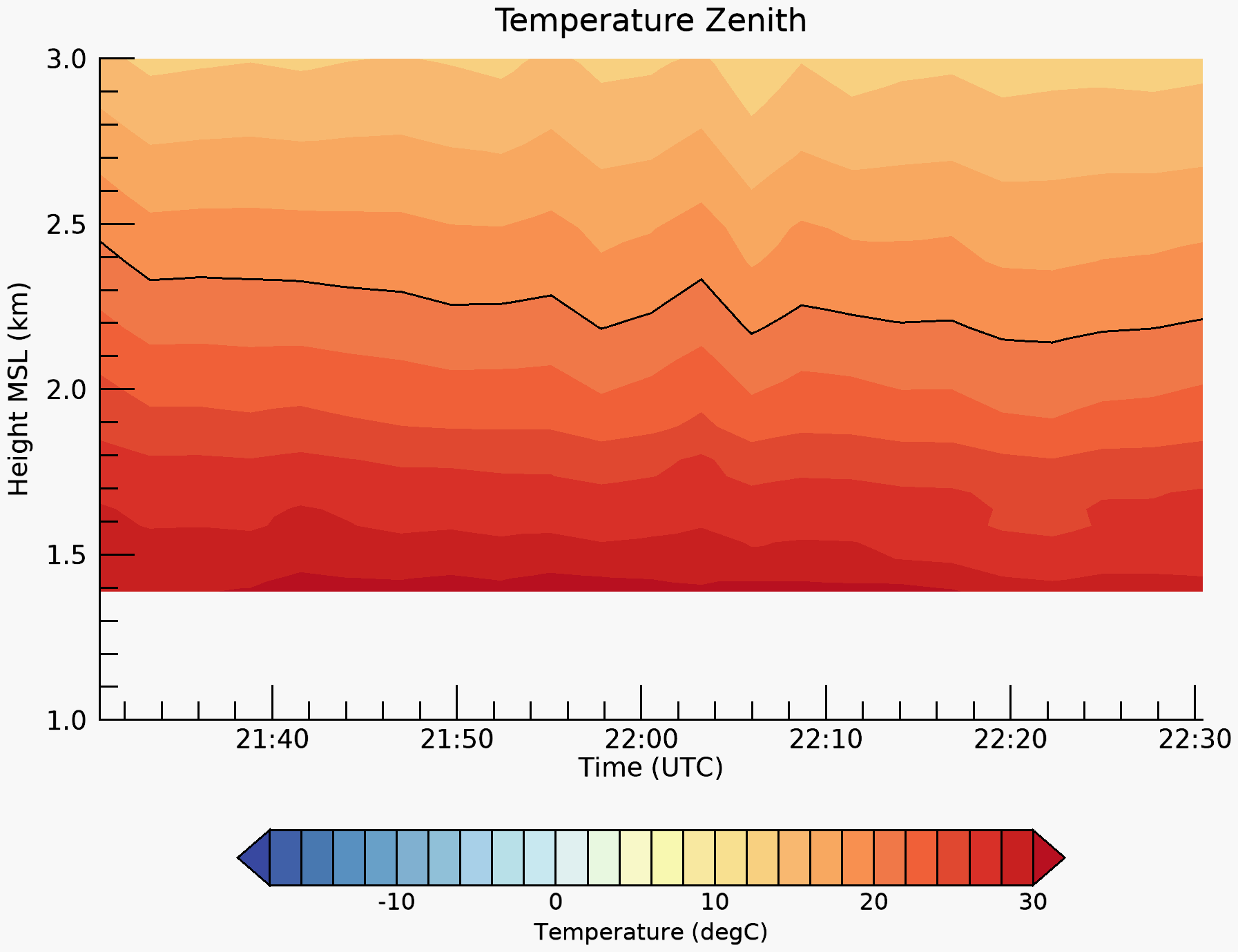
NWTC 2012-2014
Site: NWTC/CFR Coordinates: 39 54 .6340, -105 13 .4110 (indicated by white dot in the radar image) Elevation (m): 1852
* M2 Tower substitutes days without Lidar and/or Radiometer
| Date | Radar image | Lidar wind direction | Lidar wind speed | Radiometer temp | Radiometer RH |
|---|---|---|---|---|---|
| 05 June ’12 | 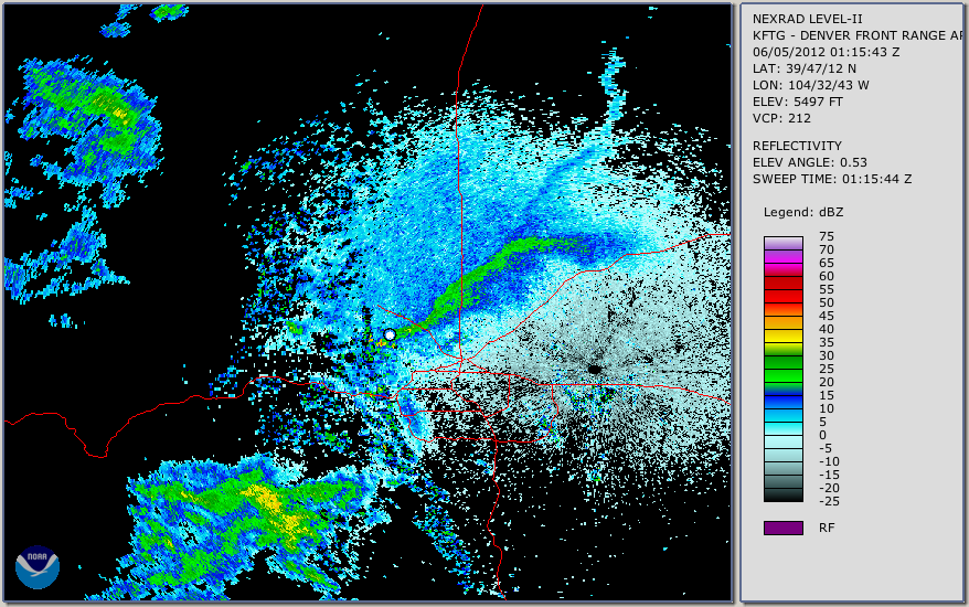 | 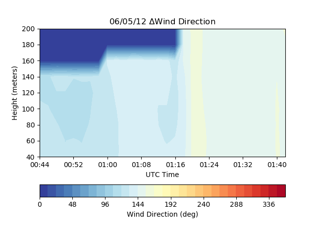 | 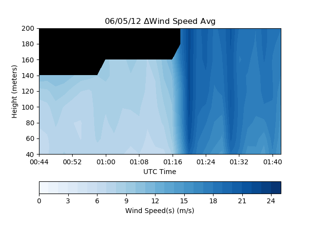 | 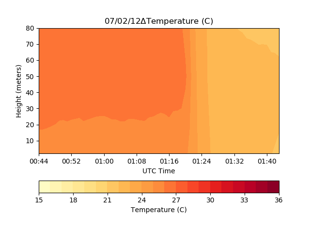 |  |
| 02 July ’12 | 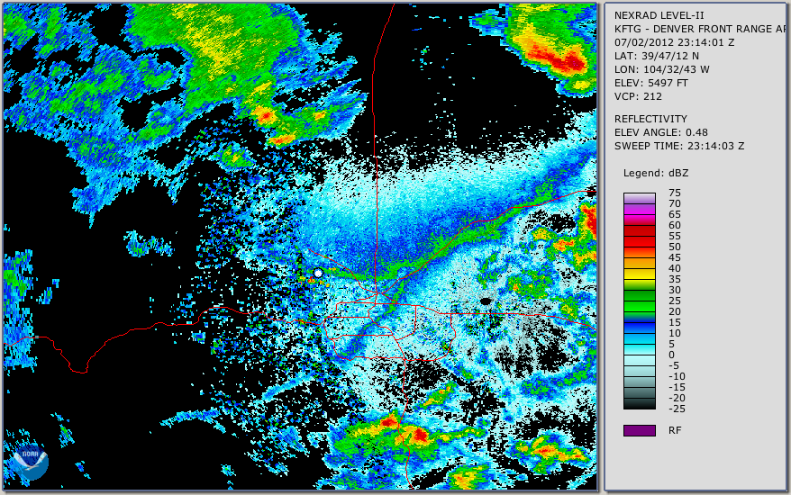 | 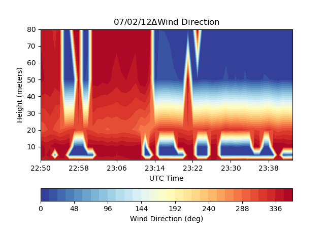 |  |  | 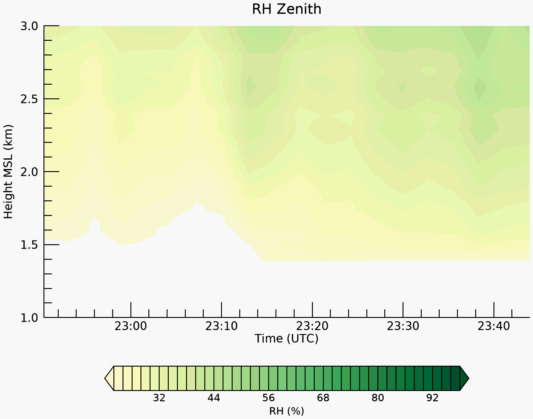 |
| 07 July ’12 | 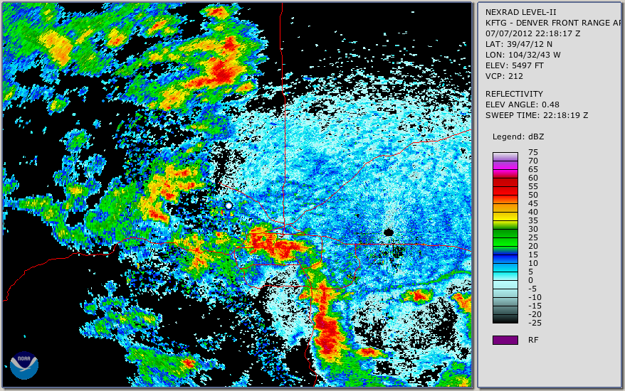 |  | 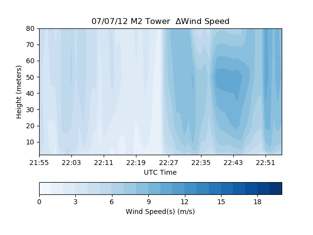 | 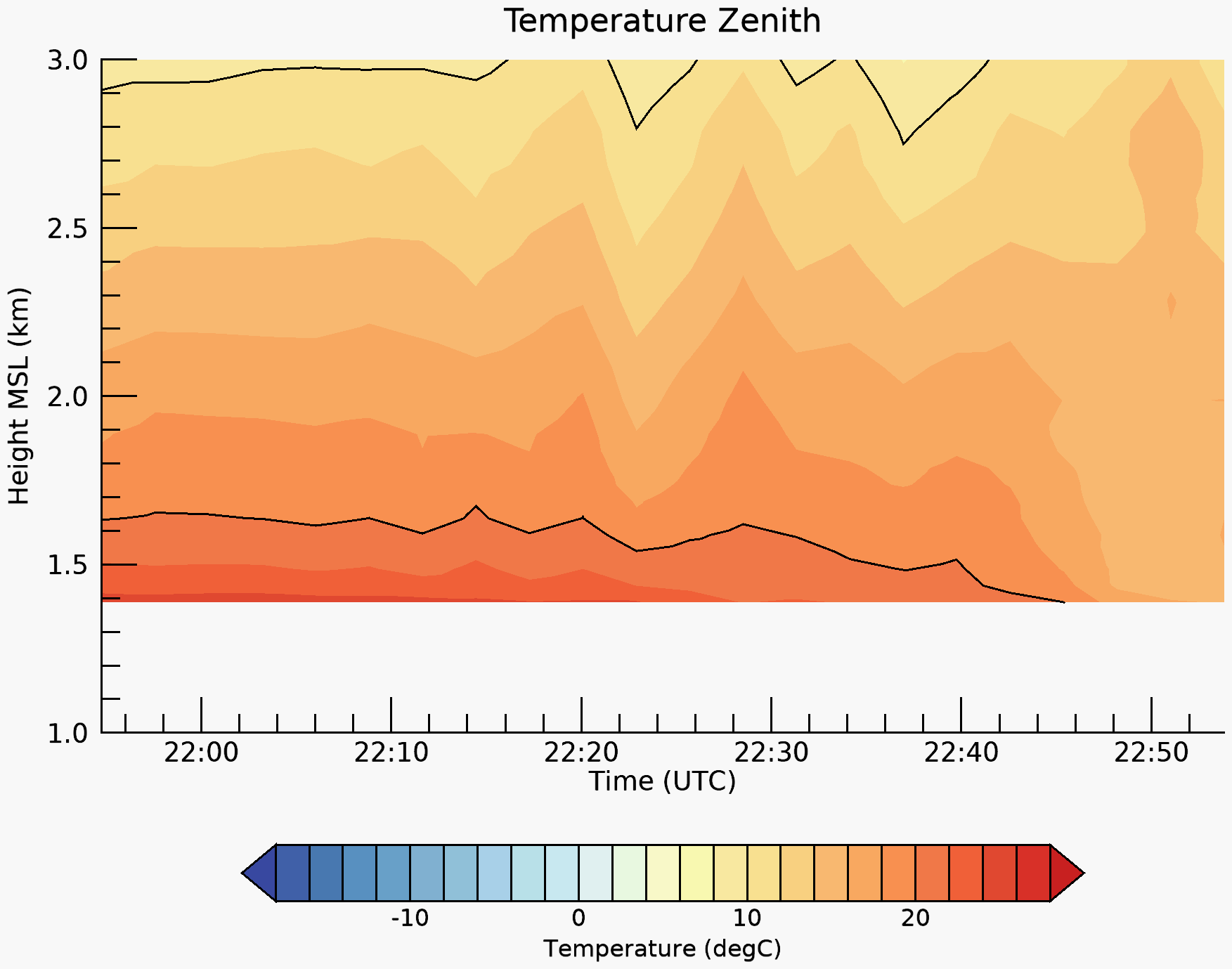 |  |
| 16 July ’12 | 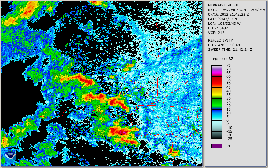 | 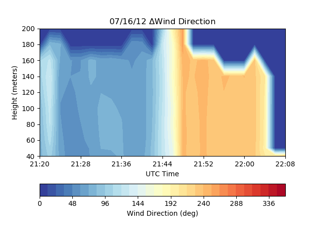 | 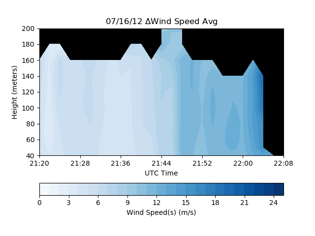 | 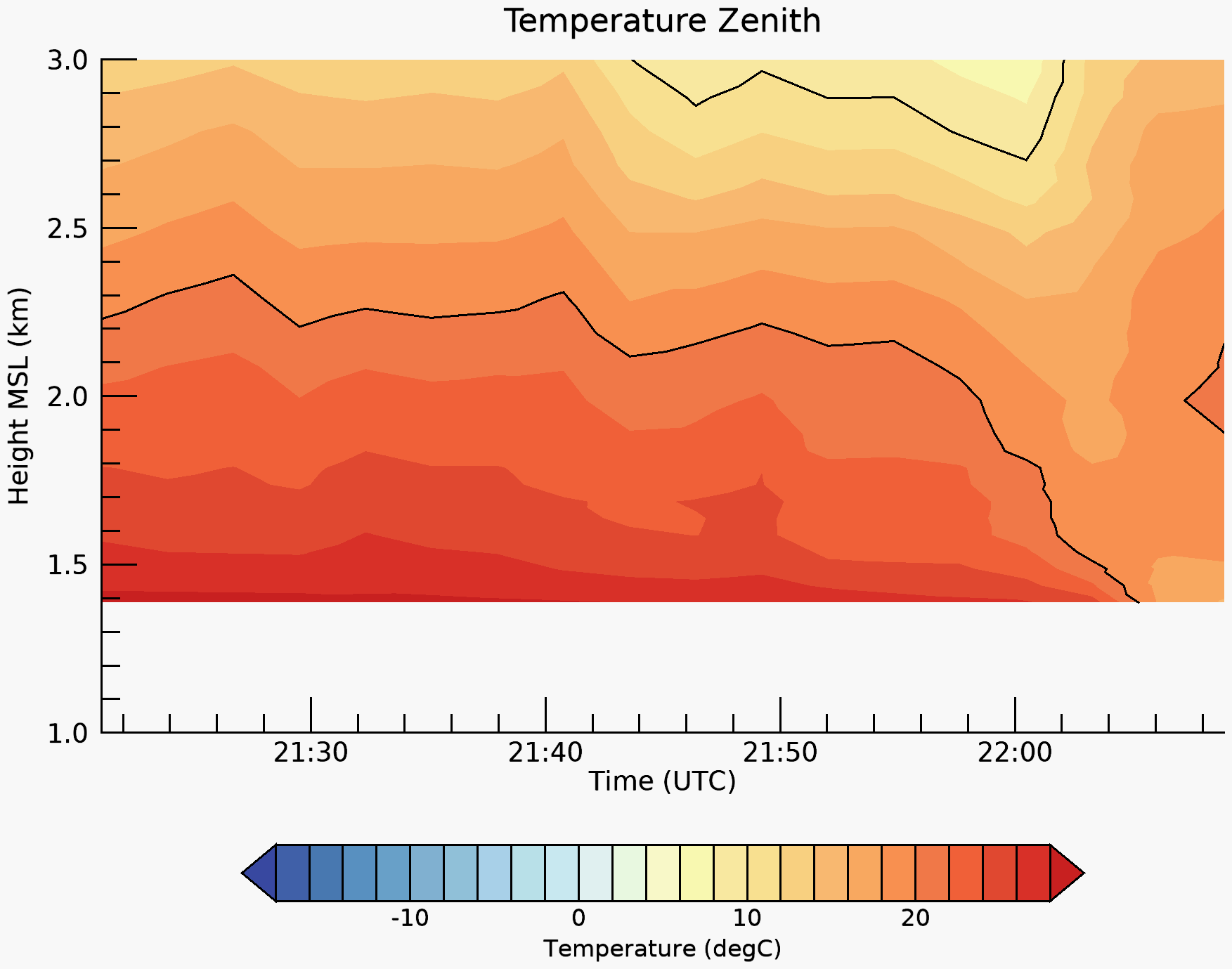 | 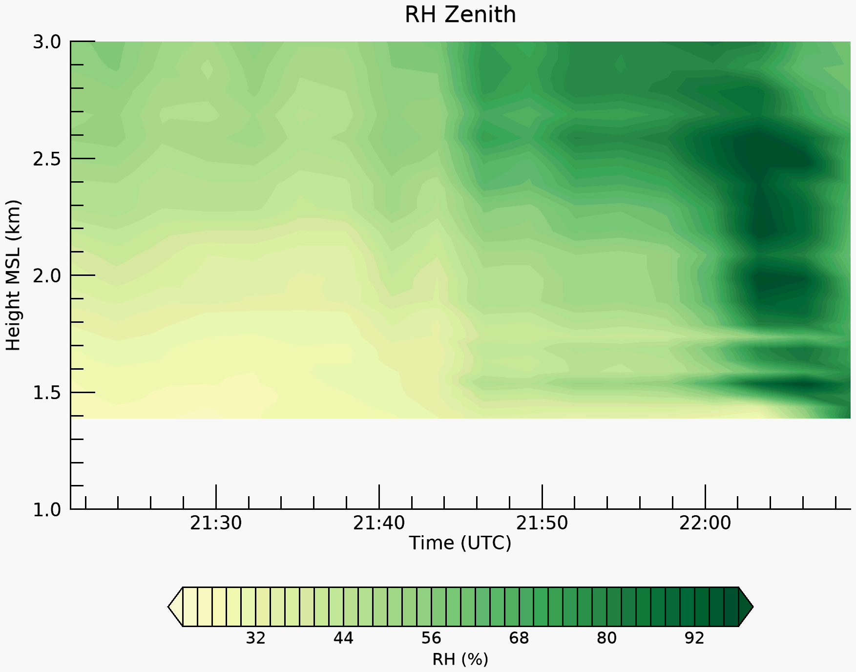 |
| 25 July ’12 | 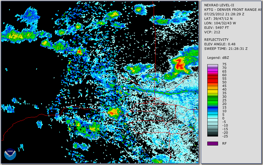 | 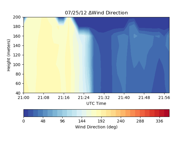 | 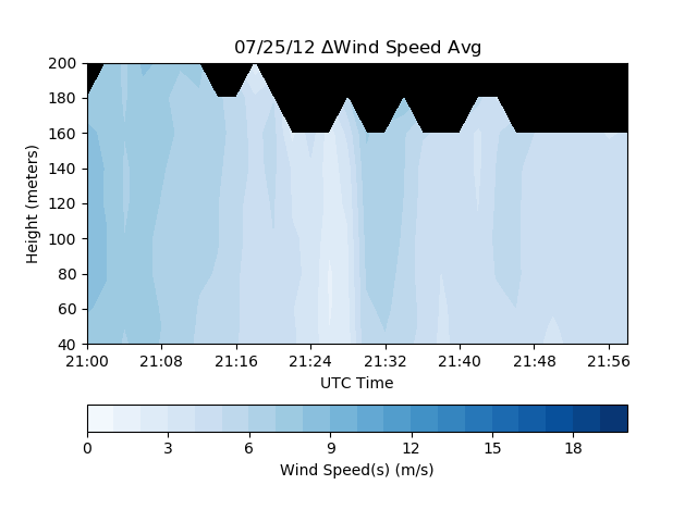 |  |  |
| 27 July ’12 | 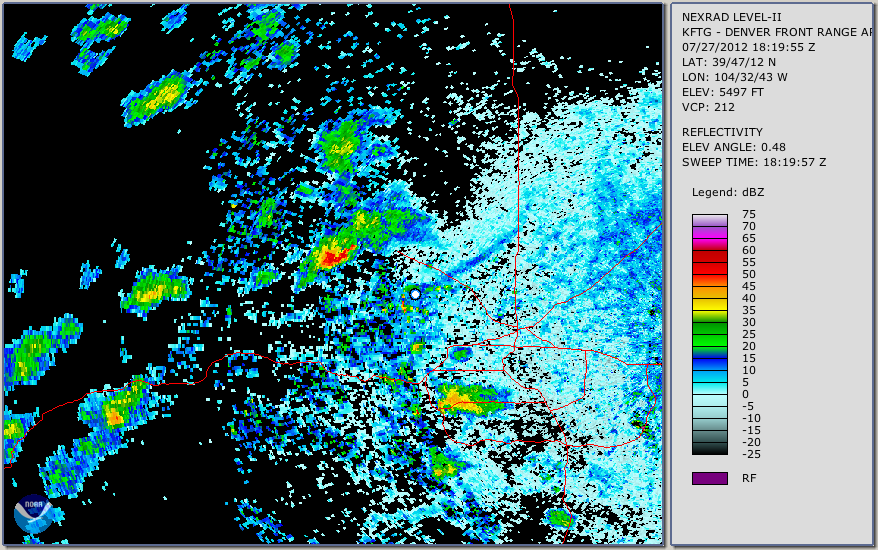 | 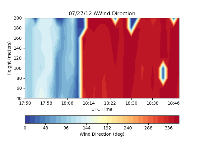 | 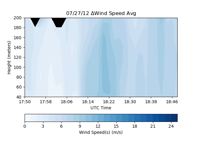 | 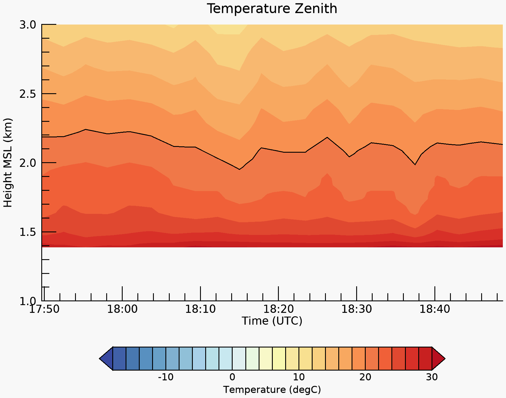 | 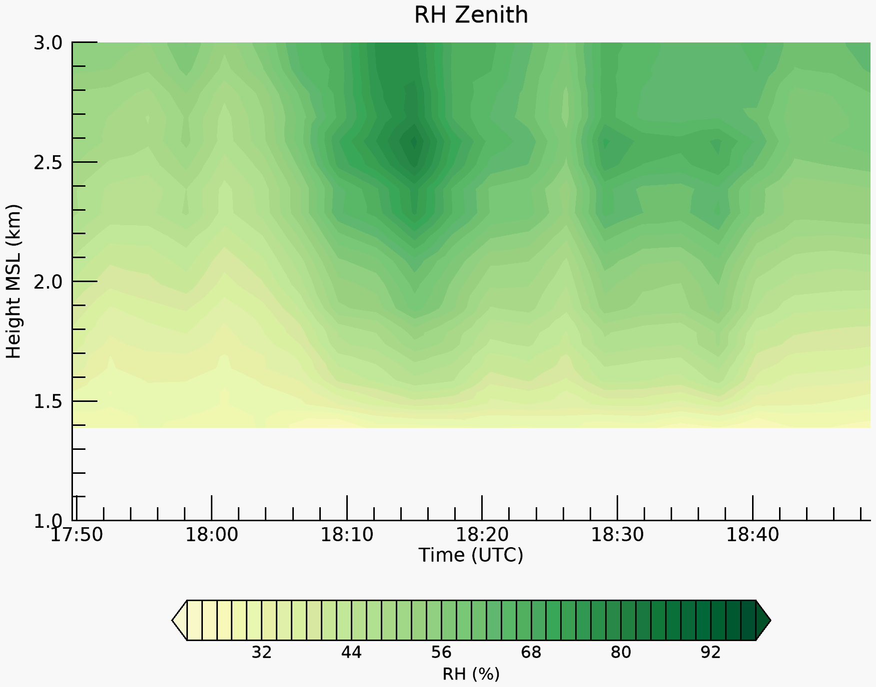 |
| 01 Aug ’12 |  | 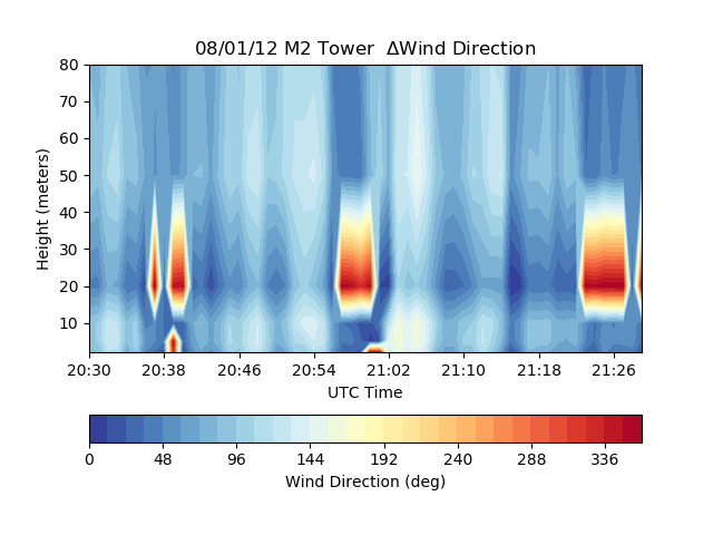 | 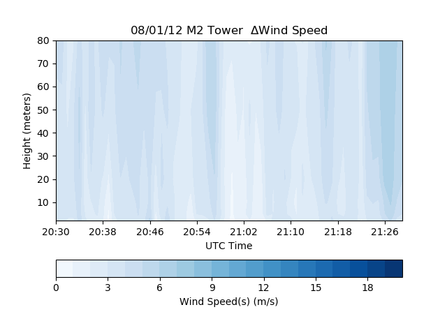 | 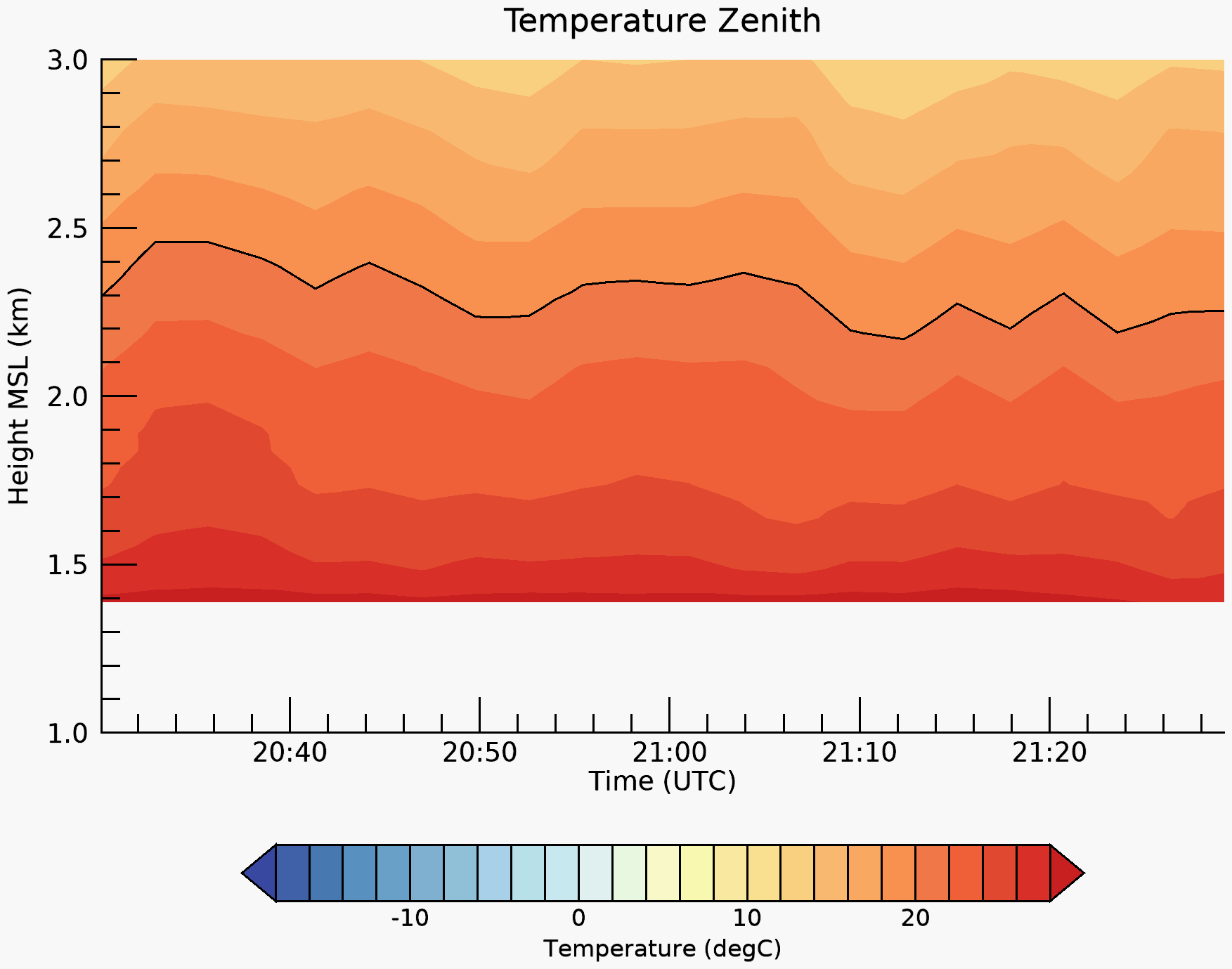 | 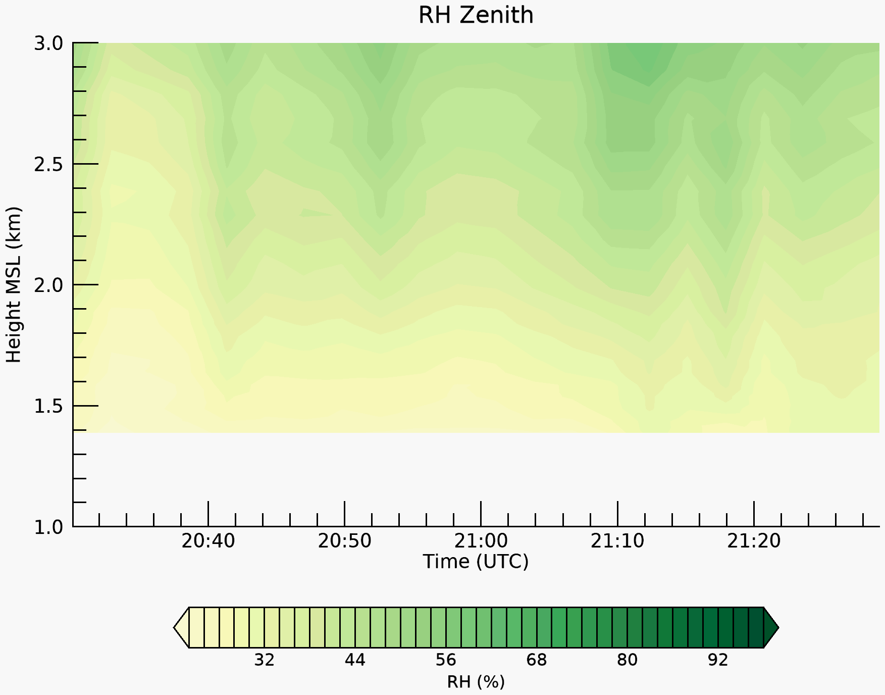 |
| 18 June ’13 |  |  | 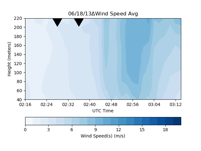 | 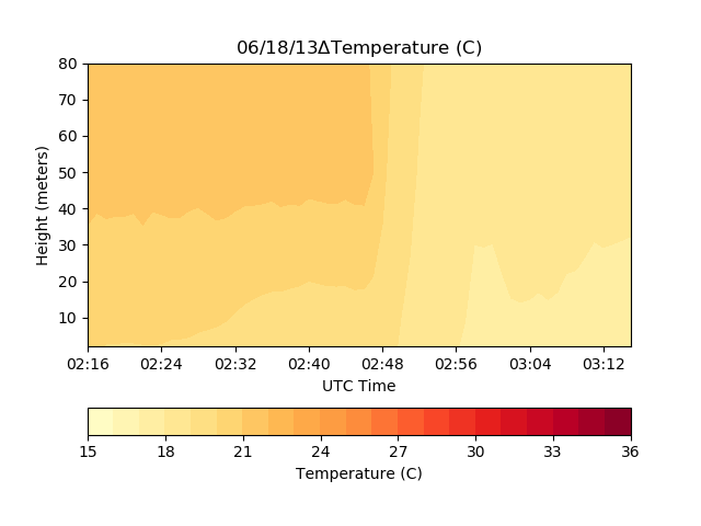 |  |
| 23 June ’14 | 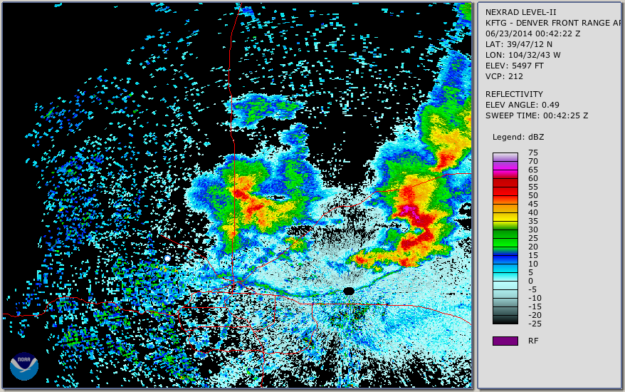 | 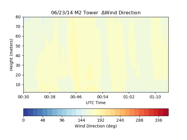 |  | 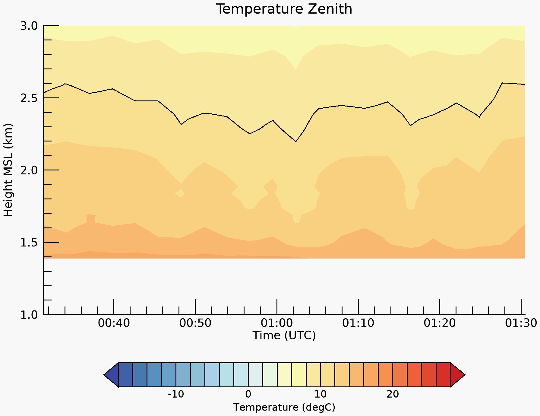 |  |
| 25 June ’14 | 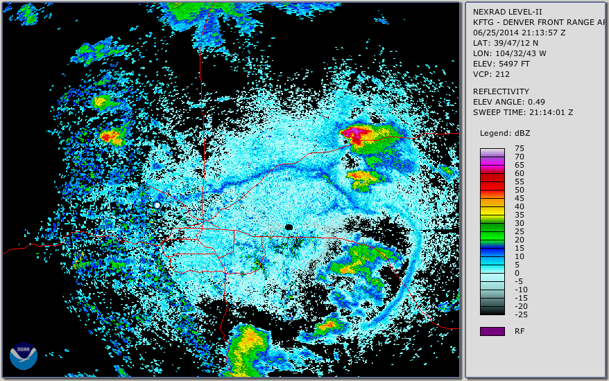 | 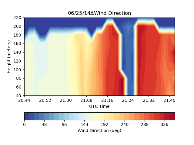 | 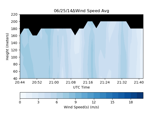 | 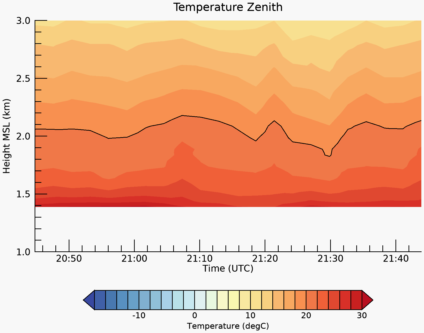 | 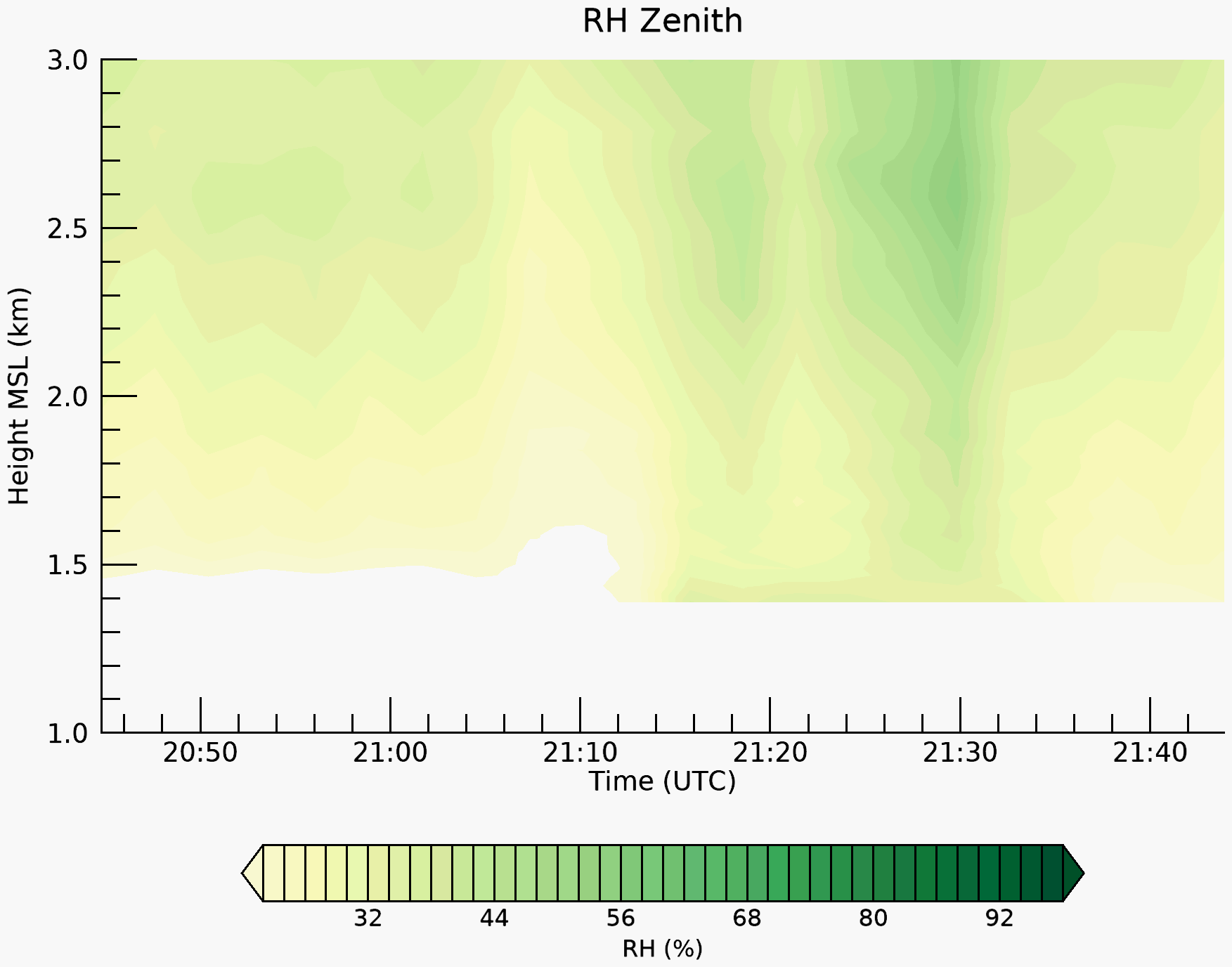 |
| 26 June ’14 | 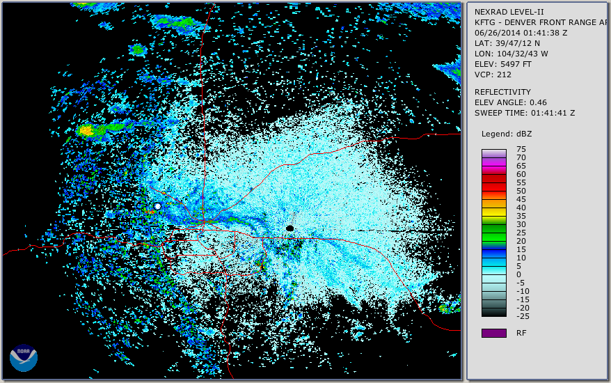 | 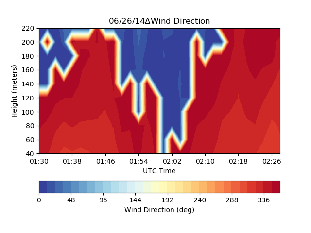 | 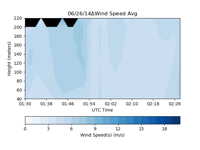 |  | 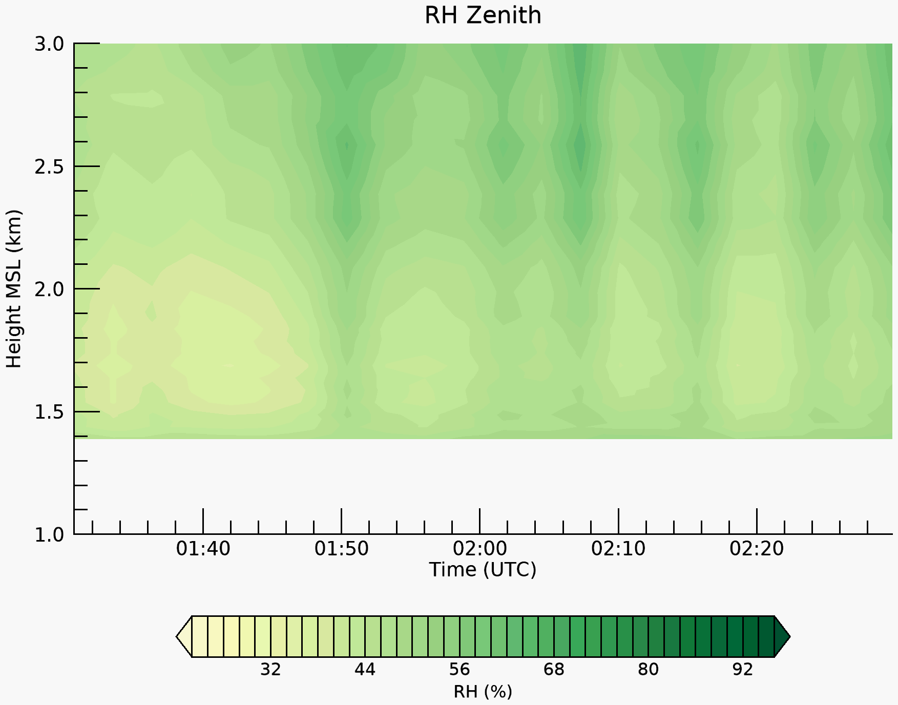 |
| 27 June ’14 |  |  | 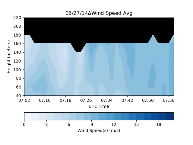 | 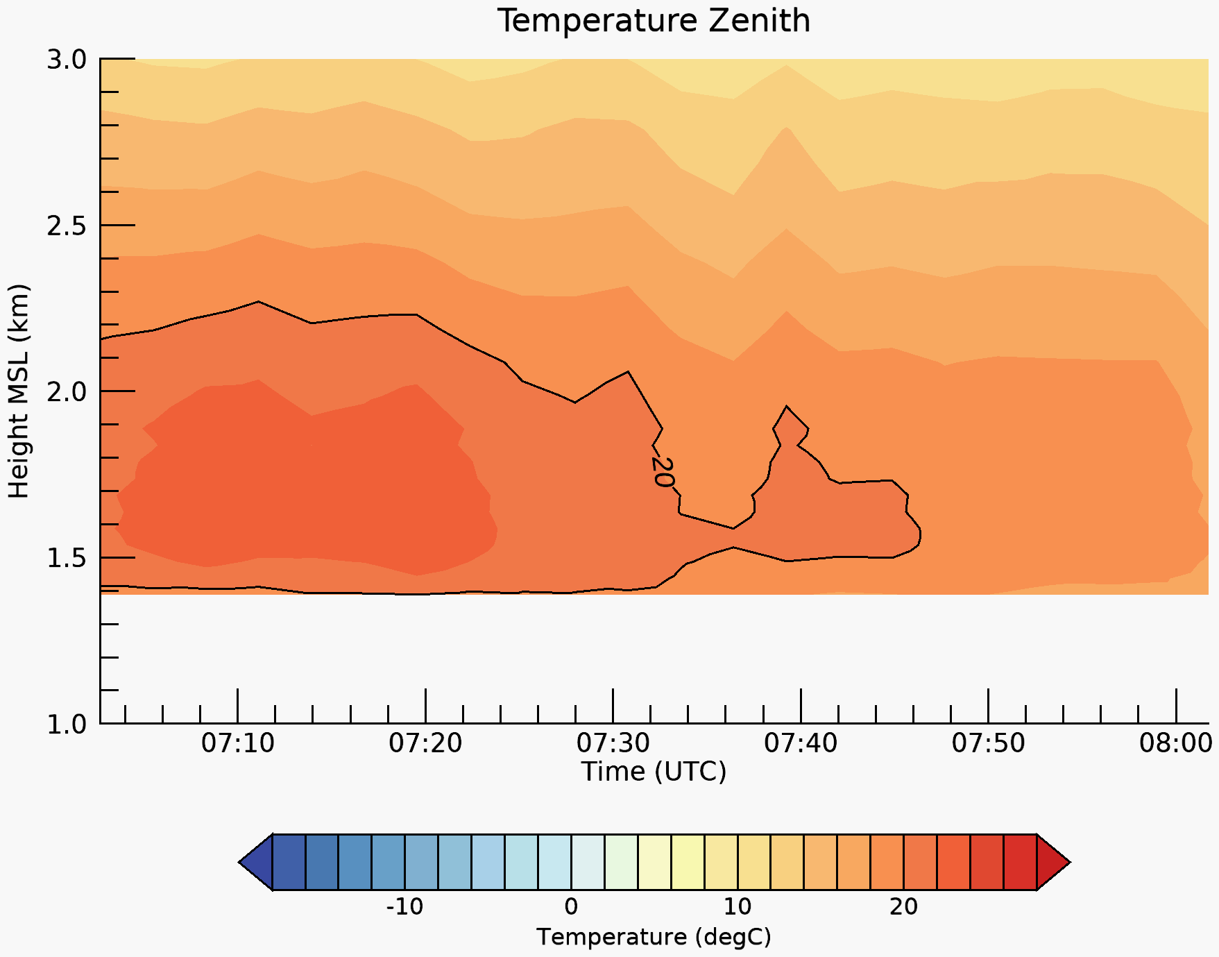 | 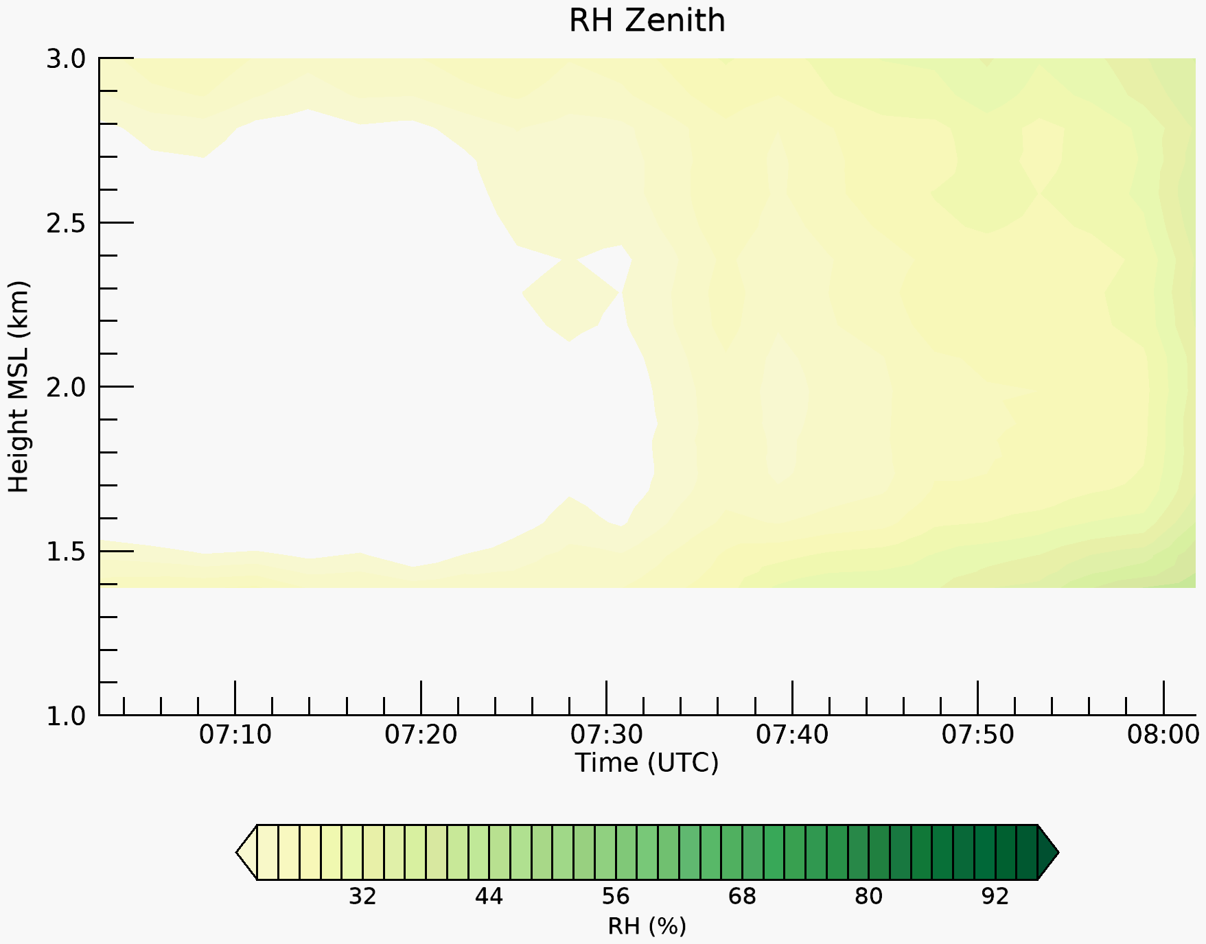 |
WFIP2 2015-2016
Site: NWTC/CFR Coordinates: 39 54 .6340,-105 13 .4110 (indicated by white dot in the radar image) Elevation (m): 1852
| Date | Radar image | Lidar wind direction | Lidar wind speed | Radiometer temp | Radiometer RH |
|---|---|---|---|---|---|
| 11 Nov ’15 | |||||
| 30 Jan ’16 | |||||
| 15 Mar ’16 | |||||
| 04 May ’16 | |||||
| 05 May ’16 | |||||
| 14 May ’16 | |||||
| 09 July ’16 | |||||
| 17 Sept ’16 | |||||
| 22 Sept ’16 | |||||
| 25 Oct ’16 | |||||
| 05 Mar ’16 | |||||
| 22 Mar ’16 |