The preferred method is to report GPS Latitude and Longitude coordinates. Latitude and longitude can be found via Google Maps. Alternatively, the nearest cross street intersection is helpful, or if the location is very distant from the nearest intersection, the number of miles from nearest intersection and cardinal direction from the intersection are necessary.
Example: The location was 5 miles south along county road 5 from the intersection of CR 5 and CR 10.
Google Maps Instructions: 1) Open Google Maps to the location, 2) Right click on the location you observed hail and click “What’s here?”, 3) Log Latitude and Longitude for the report
Note start and end time. To the nearest 5-minute interval is the most useful.
Example: Hail started falling at 3:35 pm and ended at 3:55 pm Mountain Standard Time
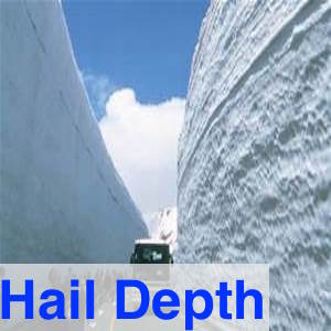
The preferred method is by ruler measurement. The average of multiple measurements provides the best information. If a ruler or other length measuring device is not available, give your best estimate. The tip of your thumb to the knuckle is about an inch. Try not to measure drifts. High winds can pile up hail up against walls or other obstacles and provide inflated depth measurements. Please report if no hail fell or if some hail did fall but no accumulation occurred.
Example: The average of 10 measurements provided a depth of 3 inches.
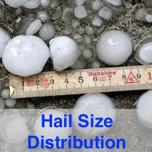
The easiest way to report hail size distribution is to put a ruler or an object with a defined length on the ground, take a picture, and send it to us. We will figure out hail size distribution.
If you cannot take a picture, the preferred method is ruler measurement. If a ruler or other length measuring device is not available, give your best estimate.
Example: The largest hail stone found was 1 inch in diameter, the smallest, 0.25 inches in diameter, and what appeared to be the average size was 0.5 inches in diameter.
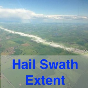
Most of the time this is difficult to estimate, but if you are in the air, take a picture and send it to us. If you are in the car, maybe drive a round the block and see if there is still hail on the ground – anything helps.
Example: Hail between Colorado and 5th Street; few hail stones beyond 5th.
Submit pictures of your surroundings. Try to capture the extent of the hail geographically. Pictures of hail depth and size are appreciated. If you want please provide your contact information and we will contact you if we have further questions.
Sample Tweets: (151 characters with spaces) @NWSBoulder #deephail 5 miles south of CR5 & CR 10 from 3:35 to 3:55 pm. Average depth: 3 inches. Max size: 1 inch, min size: 0.25 inch, avg size: 0.5 inch.
Sample Tweets: (136 characters with spaces) @NWSBoulder #deephail at Lat: 40.001, Long: 105.254. Average depth: 3 inches. Max size: 1 inch, min size: 0.25 inch, avg size: 0.5 inch.
Submit a National Weather Service Storm Report. Once you chose hail as you report type, put hail depth into the comment section. Send pictures and videos to deephailCO@gmail.com
Example: 5 miles south of CR 5 & CR 10 from 3:35 to 3:55 pm on 5/21. Average depth: 3 inches. Max size: 1 inch, min size: 0.25 inch, avg size: 0.5 inch.
